Elected Officials
Courts
Departments
Initiatives
Open Government
About
Login / Register
Home
/
Property & Tax Records
/
Property Records
/
Property & Tax Search
/
Parcel Profile
/
Print View
Search for Another Parcel
Parcel Profile
Historical Card
Sketches
Photos
Tax Map
Taxes
Print View
Print This Page
Address: 330 E 10 ST
Parcel: 15020016011200
Parcel Profile
Address
330 | E | 10 | ST
Street Status
PAVED | SIDEWALK
School District
CITY OF ERIE SCHOOL
Acreage
1.7265
Classification
E
Land Use Code
EXEMPT NON-PROFIT ORGANIZATIONS
Legal Description
330 E 10 ST 1.7265 AC
Square Feet
42896
Topo
LEVEL
Utility
ALL PUBLIC
Zoning
Please contact your municipal zoning officer
Deed Book
0486
Deed Page
1172
2026 Tax Values
Land Value / Taxable
97,100 / 97,100.00
Building Value / Taxable
754,100 / 754,100.00
Total Value / Taxable
851,200 / 851,200.00
Clean & Green
Inactive
Homestead Status
Inactive
Farmstead Status
Inactive
Lerta Amount
0
Lerta Expiration Year
0
Commercial Data
Card 1
OFFICE BLDG L/R 1-4S
Business Living Area - 42896
Year Built - 1980
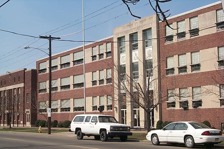
Improvement Name - ST BEN'S EDUCATION CENTER
Value - 1145340
Other Buildings & Yards
No OBY Data Found
Sales History
Sale Date
Type
Price
Book / Page
Other Info
3/6/1997
0
0486 / 1172
1/28/1942
0
0416 / 0049
1/28/1942
0
0415 / 0568
Parcel Sketches
Commercial Card 1
A
MAIN
10724 square feet
B
MAIN
10724 square feet
C
MAIN
10724 square feet
D
MAIN
10724 square feet
Parcel Images
Please note:
this tab is for informational purposes only and may not show all delinquencies, see the Taxes tab for more accurate delinquent taxes due.