Elected Officials
Courts
Departments
Initiatives
Open Government
About
Login / Register
Home
/
Property & Tax Records
/
Property Records
/
Property & Tax Search
/
Parcel Profile
/
Print View
Search for Another Parcel
Parcel Profile
Historical Card
Sketches
Photos
Tax Map
Taxes
Print View
Print This Page
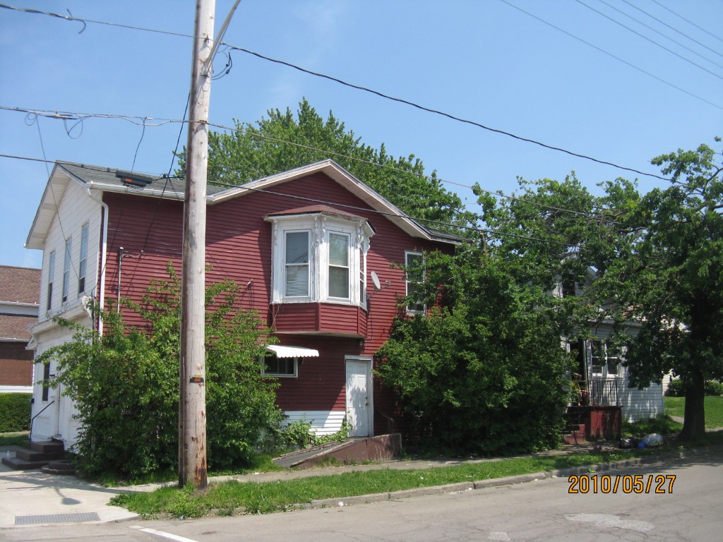
Address: 301 E 12 ST
Parcel: 15020018022000
Parcel Profile
Address
301 | E | 12 | ST
Street Status
PAVED | SIDEWALK
School District
CITY OF ERIE SCHOOL
Acreage
0.0498
Classification
A
Land Use Code
APARTMENTS 4 - 19 UNITS
Legal Description
301 E 12 ST 60.3 X 36
Square Feet
3747
Topo
LEVEL
Utility
ALL PUBLIC
Zoning
Please contact your municipal zoning officer
Deed Book
2023
Deed Page
018856
2026 Tax Values
Land Value / Taxable
6,500 / 6,500.00
Building Value / Taxable
48,131 / 48,131.00
Total Value / Taxable
54,631 / 54,631.00
Clean & Green
Inactive
Homestead Status
Inactive
Farmstead Status
Inactive
Lerta Amount
0
Lerta Expiration Year
0
Commercial Data
Card 1
RESIDENTIAL 4 FAMILY
Business Living Area - 3747
Year Built - 1900
Improvement Name - APARTMENTS
Value - 45740
Other Buildings & Yards
No OBY Data Found
Sales History
Sale Date
Type
Price
Book / Page
Other Info
10/31/2023
LAND & BUILDING
770000
2023 / 018856
SPECIAL WARRANTY DEED
8/25/1997
0
0515 / 0942
Parcel Sketches
Commercial Card 1
A
MAIN
748 square feet
B
MAIN
1564 square feet
C
MAIN
1435 square feet
Parcel Images
Please note:
this tab is for informational purposes only and may not show all delinquencies, see the Taxes tab for more accurate delinquent taxes due.