Elected Officials
Courts
Departments
Initiatives
Open Government
About
Login / Register
Home
/
Property & Tax Records
/
Property Records
/
Property & Tax Search
/
Parcel Profile
/
Print View
Search for Another Parcel
Parcel Profile
Historical Card
Sketches
Photos
Tax Map
Taxes
Print View
Print This Page
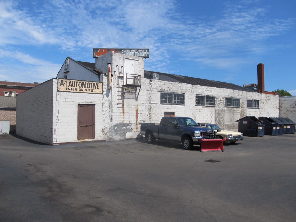
Address: 419 E 9 ST
Parcel: 15020021011200
Parcel Profile
Address
419 | E | 9 | ST
Street Status
PAVED | SIDEWALK
School District
CITY OF ERIE SCHOOL
Acreage
0.2655
Classification
C
Land Use Code
WAREHOUSES
Legal Description
419 E 9 ST 40 X 160
Square Feet
10905
Topo
LEVEL
Utility
ALL PUBLIC
Zoning
Please contact your municipal zoning officer
Deed Book
0909
Deed Page
0417
2026 Tax Values
Land Value / Taxable
17,400 / 17,400.00
Building Value / Taxable
32,600 / 32,600.00
Total Value / Taxable
50,000 / 50,000.00
Clean & Green
Inactive
Homestead Status
Inactive
Farmstead Status
Inactive
Lerta Amount
0
Lerta Expiration Year
0
Commercial Data
Card 1
WAREHOUSE
Business Living Area - 10905
Year Built - 1954
Improvement Name - WAREHOUSE
Value - 89770
Other Buildings & Yards
No OBY Data Found
Sales History
Sale Date
Type
Price
Book / Page
Other Info
8/9/2002
LAND & BUILDING
12750
0909 / 0417
3/28/2002
LAND & BUILDING
0
866 / 532
AFFIDAVIT
5/11/1998
0
0560 / 1195
7/21/1997
0
0509 / 1513
11/22/1996
0
0472 / 1073
11/18/1996
0
0471 / 1496
1/3/1956
0
0719 / 0199
Parcel Sketches
Commercial Card 1
A
MAIN
9228 square feet
B
MAIN
10905 square feet
Parcel Images
Please note:
this tab is for informational purposes only and may not show all delinquencies, see the Taxes tab for more accurate delinquent taxes due.