Elected Officials
Courts
Departments
Initiatives
Open Government
About
Login / Register
Home
/
Property & Tax Records
/
Property Records
/
Property & Tax Search
/
Parcel Profile
/
Print View
Search for Another Parcel
Parcel Profile
Historical Card
Sketches
Photos
Tax Map
Taxes
Print View
Print This Page
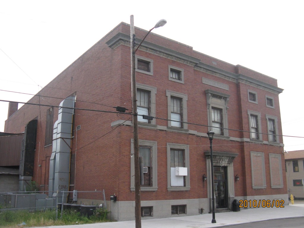
Address: 829 E PARADE ST
Parcel: 15020021022400
Parcel Profile
Address
829 | E | PARADE | ST
Street Status
PAVED | SIDEWALK
School District
CITY OF ERIE SCHOOL
Acreage
1.1722
Classification
C
Land Use Code
NON-PROFIT ORG-ELKS,KNIGHTS OF COLUM ETC
Legal Description
829 PARADE ST 1.1722 AC
Square Feet
34006
Topo
LEVEL
Utility
ALL PUBLIC
Zoning
Please contact your municipal zoning officer
Deed Book
2012
Deed Page
017446
2026 Tax Values
Land Value / Taxable
35,200 / 35,200.00
Building Value / Taxable
59,900 / 59,900.00
Total Value / Taxable
95,100 / 95,100.00
Clean & Green
Inactive
Homestead Status
Inactive
Farmstead Status
Inactive
Lerta Amount
0
Lerta Expiration Year
0
Commercial Data
Card 1
SOCIAL/FRATERNAL HALL
Business Living Area - 9124
Year Built - 1890
Improvement Name - HIGHER LEARNING CHILD CARE
Value - 133290
Card 2
SOCIAL/FRATERNAL HALL
Business Living Area - 24882
Year Built - 1927
Improvement Name - EAST ERIE TURNERS
Value - 428850
Other Buildings & Yards
No OBY Data Found
Sales History
Sale Date
Type
Price
Book / Page
Other Info
7/2/2012
LAND & BUILDING
80000
2012 / 017446
SPECIAL WARRANTY DEED
11/4/2011
LAND & BUILDING
44945
2011 / 026519
SHERIFF'S DED
7/12/2006
LAND & BUILDING
0
1343 / 2277
DEED
1/1/1969
0
0446 / 0458
8/3/1944
0
0446 / 0458
5/26/1941
0
0411 / 0224
Parcel Sketches
Commercial Card 1
A
MAIN
4100 square feet
B
MAIN
5024 square feet
Commercial Card 2
A
MAIN
8170 square feet
B
MAIN
8510 square feet
C
MAIN
8202 square feet
Parcel Images
Please note:
this tab is for informational purposes only and may not show all delinquencies, see the Taxes tab for more accurate delinquent taxes due.