Elected Officials
Courts
Departments
Initiatives
Open Government
About
Login / Register
Home
/
Property & Tax Records
/
Property Records
/
Property & Tax Search
/
Parcel Profile
/
Print View
Search for Another Parcel
Parcel Profile
Historical Card
Sketches
Photos
Tax Map
Taxes
Print View
Print This Page
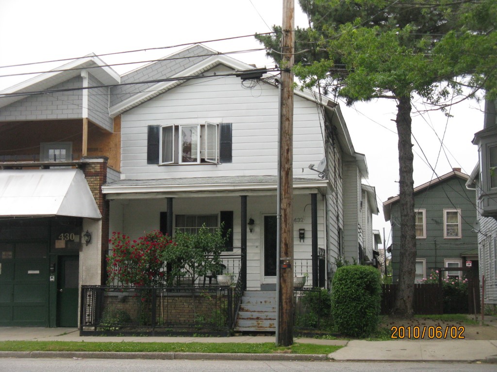
Address: 432 E 12 ST
Parcel: 15020022013400
Parcel Profile
Address
432 | E | 12 | ST
Street Status
PAVED | SIDEWALK
School District
CITY OF ERIE SCHOOL
Acreage
0.1468
Classification
C
Land Use Code
WAREHOUSES
Legal Description
432 E 12 ST 41.25 X 155
Square Feet
9022
Topo
LEVEL
Utility
ALL PUBLIC
Zoning
Please contact your municipal zoning officer
Deed Book
2013
Deed Page
012034
2026 Tax Values
Land Value / Taxable
9,600 / 9,600.00
Building Value / Taxable
119,400 / 119,400.00
Total Value / Taxable
129,000 / 129,000.00
Clean & Green
Inactive
Homestead Status
Inactive
Farmstead Status
Inactive
Lerta Amount
0.00
Lerta Expiration Year
2014
Commercial Data
Card 1
MIXED RES/COMM
Business Living Area - 9022
Year Built - 1872
Improvement Name - HOUSE NO NAME ON GARAGE
Value - 119370
Other Buildings & Yards
No OBY Data Found
Sales History
Sale Date
Type
Price
Book / Page
Other Info
5/15/2013
LAND & BUILDING
0
2013 / 012034
QUIT CLAIM DEED
7/23/1992
0
0222 / 2324
8/11/1981
0
1429 / 0564
8/15/1974
0
1126 / 0506
1/25/1967
0
0954 / 0584
8/22/1966
0
0946 / 0478
12/3/1965
0
0930 / 0086
2/9/1944
0
0443 / 0485
2/14/1939
0
0386 / 0038
Parcel Sketches
Commercial Card 1
A
MAIN
3000 square feet
B
MAIN
1476 square feet
C
MAIN
1598 square feet
D
MAIN
2948 square feet
Parcel Images
Please note:
this tab is for informational purposes only and may not show all delinquencies, see the Taxes tab for more accurate delinquent taxes due.