Elected Officials
Courts
Departments
Initiatives
Open Government
About
Login / Register
Home
/
Property & Tax Records
/
Property Records
/
Property & Tax Search
/
Parcel Profile
/
Print View
Search for Another Parcel
Parcel Profile
Historical Card
Sketches
Photos
Tax Map
Taxes
Print View
Print This Page
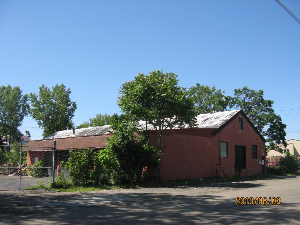
Address: 443 45 E 17 ST
Parcel: 15020025010200
Parcel Profile
Address
443 | 45 | E | 17 | ST
Street Status
PAVED | SIDEWALK
School District
CITY OF ERIE SCHOOL
Acreage
0.7646
Classification
C
Land Use Code
WAREHOUSES
Legal Description
443 45 E 17 ST 2025.21 SQ FT
Square Feet
9380
Topo
LEVEL
Utility
ALL PUBLIC
Zoning
Please contact your municipal zoning officer
Deed Book
2010
Deed Page
025676
2026 Tax Values
Land Value / Taxable
35,000 / 35,000.00
Building Value / Taxable
15,000 / 15,000.00
Total Value / Taxable
50,000 / 50,000.00
Clean & Green
Inactive
Homestead Status
Inactive
Farmstead Status
Inactive
Lerta Amount
0
Lerta Expiration Year
0
Commercial Data
Card 1
WAREHOUSE
Business Living Area - 9380
Year Built - 1955
Improvement Name - VACANT
Value - 14000
Other Buildings & Yards
Description
Built
Width
Length
Area
PAVING ASPHALT PARKING
1980
0
0
18500
Sales History
Sale Date
Type
Price
Book / Page
Other Info
10/15/2010
LAND & BUILDING
50000
2010 / 025676
SPECIAL WARRANTY DEED
3/11/2009
LAND & BUILDING
0
1548 / 0619
TAX DEED
10/16/1996
0
0466 / 1504
Parcel Sketches
Commercial Card 1
A
MAIN
9380 square feet
Parcel Images
Please note:
this tab is for informational purposes only and may not show all delinquencies, see the Taxes tab for more accurate delinquent taxes due.