Elected Officials
Courts
Departments
Initiatives
Open Government
About
Login / Register
Home
/
Property & Tax Records
/
Property Records
/
Property & Tax Search
/
Parcel Profile
/
Print View
Search for Another Parcel
Parcel Profile
Historical Card
Sketches
Photos
Tax Map
Taxes
Print View
Print This Page
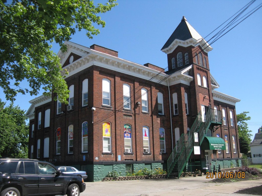
Address: 554 E 10TH ST
Parcel: 15020026010000
Parcel Profile
Address
554 | E | 10TH | ST
Street Status
PAVED | SIDEWALK
School District
CITY OF ERIE SCHOOL
Acreage
0.7025
Classification
E
Land Use Code
EXEMPT NON-PROFIT ORGANIZATIONS
Legal Description
554 E 10TH ST 193.25X160
Square Feet
23559
Topo
LEVEL
Utility
ALL PUBLIC
Zoning
Please contact your municipal zoning officer
Deed Book
2011
Deed Page
022307
2026 Tax Values
Land Value / Taxable
38,300 / 38,300.00
Building Value / Taxable
267,500 / 267,500.00
Total Value / Taxable
305,800 / 305,800.00
Clean & Green
Inactive
Homestead Status
Inactive
Farmstead Status
Inactive
Lerta Amount
0
Lerta Expiration Year
0
Commercial Data
Card 1
SCHOOL
Business Living Area - 23559
Year Built - 1880
Improvement Name - SPANISH AMERICAN COUNCIL
Value - 405350
Other Buildings & Yards
No OBY Data Found
Sales History
Sale Date
Type
Price
Book / Page
Other Info
9/20/2011
LAND & BUILDING
0
2011 / 022307
QUIT CLAIM DEED
2/4/1999
0
0616 / 0577
Parcel Sketches
Commercial Card 1
A
MAIN
7853 square feet
B
MAIN
7853 square feet
C
MAIN
7853 square feet
Parcel Images
Please note:
this tab is for informational purposes only and may not show all delinquencies, see the Taxes tab for more accurate delinquent taxes due.