Elected Officials
Courts
Departments
Initiatives
Open Government
About
Login / Register
Home
/
Property & Tax Records
/
Property Records
/
Property & Tax Search
/
Parcel Profile
/
Print View
Search for Another Parcel
Parcel Profile
Historical Card
Sketches
Photos
Tax Map
Taxes
Print View
Print This Page
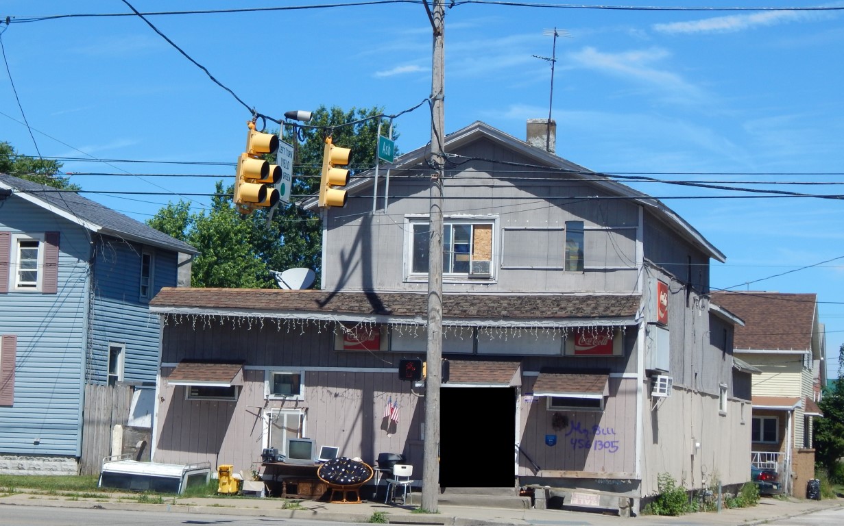
Address: 560 E 12 ST
Parcel: 15020027010000
Parcel Profile
Address
560 | E | 12 | ST
Street Status
PAVED | SIDEWALK
School District
CITY OF ERIE SCHOOL
Acreage
0.1642
Classification
R
Land Use Code
SINGLE FAMILY
Legal Description
560 E 12 ST 39.75X79.7
Square Feet
3264
Topo
LEVEL
Utility
ALL PUBLIC
Zoning
Please contact your municipal zoning officer
Deed Book
2024
Deed Page
004005
2026 Tax Values
Land Value / Taxable
10,700 / 10,700.00
Building Value / Taxable
11,825 / 11,825.00
Total Value / Taxable
22,525 / 22,525.00
Clean & Green
Inactive
Homestead Status
Active
Farmstead Status
Inactive
Lerta Amount
0
Lerta Expiration Year
0
Commercial Data
Card 1
MIXED RES/COMM
Business Living Area - 3264
Year Built - 1872
Improvement Name - ASH STREET PUB
Value - 44190
Other Buildings & Yards
No OBY Data Found
Sales History
Sale Date
Type
Price
Book / Page
Other Info
3/18/2024
LAND & BUILDING
50000
2024 / 004005
SPECIAL WARRANTY DEED
11/27/2019
LAND & BUILDING
30000
2019 / 024520
SPECIAL WARRANTY DEED
7/23/2012
LAND & BUILDING
13000
2012 / 019674
SPECIAL WARRANTY DEED
3/1/1979
0
1340 / 0261
Parcel Sketches
Commercial Card 1
A
MAIN
2076 square feet
B
MAIN
2076 square feet
C
MAIN
1188 square feet
Parcel Images
Please note:
this tab is for informational purposes only and may not show all delinquencies, see the Taxes tab for more accurate delinquent taxes due.