Elected Officials
Courts
Departments
Initiatives
Open Government
About
Login / Register
Home
/
Property & Tax Records
/
Property Records
/
Property & Tax Search
/
Parcel Profile
/
Print View
Search for Another Parcel
Parcel Profile
Historical Card
Sketches
Photos
Tax Map
Taxes
Print View
Print This Page
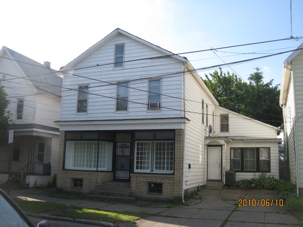
Address: 609 E 13 ST
Parcel: 15020033021600
Parcel Profile
Address
609 | E | 13 | ST
Street Status
PAVED
School District
CITY OF ERIE SCHOOL
Acreage
0.1033
Classification
R
Land Use Code
SINGLE FAMILY
Legal Description
609 E 13 ST 40 X 112.5 | 0.1033 AC
Square Feet
3180
Topo
LEVEL
Utility
ALL PUBLIC
Zoning
Please contact your municipal zoning officer
Deed Book
1212
Deed Page
2197
2026 Tax Values
Land Value / Taxable
6,300 / 6,300.00
Building Value / Taxable
36,900 / 36,900.00
Total Value / Taxable
43,200 / 43,200.00
Clean & Green
Inactive
Homestead Status
Active
Farmstead Status
Inactive
Lerta Amount
0
Lerta Expiration Year
0
Commercial Data
Card 1
MIXED RESIDENTIAL/COMMERCIAL
Business Living Area - 3180
Year Built - 1882
Improvement Name - VACANT STORE
Value - 40960
Other Buildings & Yards
No OBY Data Found
Sales History
Sale Date
Type
Price
Book / Page
Other Info
2/24/2005
LAND & BUILDING
53000
1212 / 2197
WARRANTY/SURVIVORSHIP DEED
5/20/2004
LAND & BUILDING
7000
1137 / 0434
DEED
5/12/2003
LAND & BUILDING
0
1010 / 897
AFFIDAVIT
9/15/1988
0
0064 / 1041
4/5/1965
0
0913 / 0490
Parcel Sketches
Commercial Card 1
A
MAIN
1030 square feet
B
MAIN
1270 square feet
C
MAIN
880 square feet
Parcel Images
Please note:
this tab is for informational purposes only and may not show all delinquencies, see the Taxes tab for more accurate delinquent taxes due.