Elected Officials
Courts
Departments
Initiatives
Open Government
About
Login / Register
Home
/
Property & Tax Records
/
Property Records
/
Property & Tax Search
/
Parcel Profile
/
Print View
Search for Another Parcel
Parcel Profile
Historical Card
Sketches
Photos
Tax Map
Taxes
Print View
Print This Page
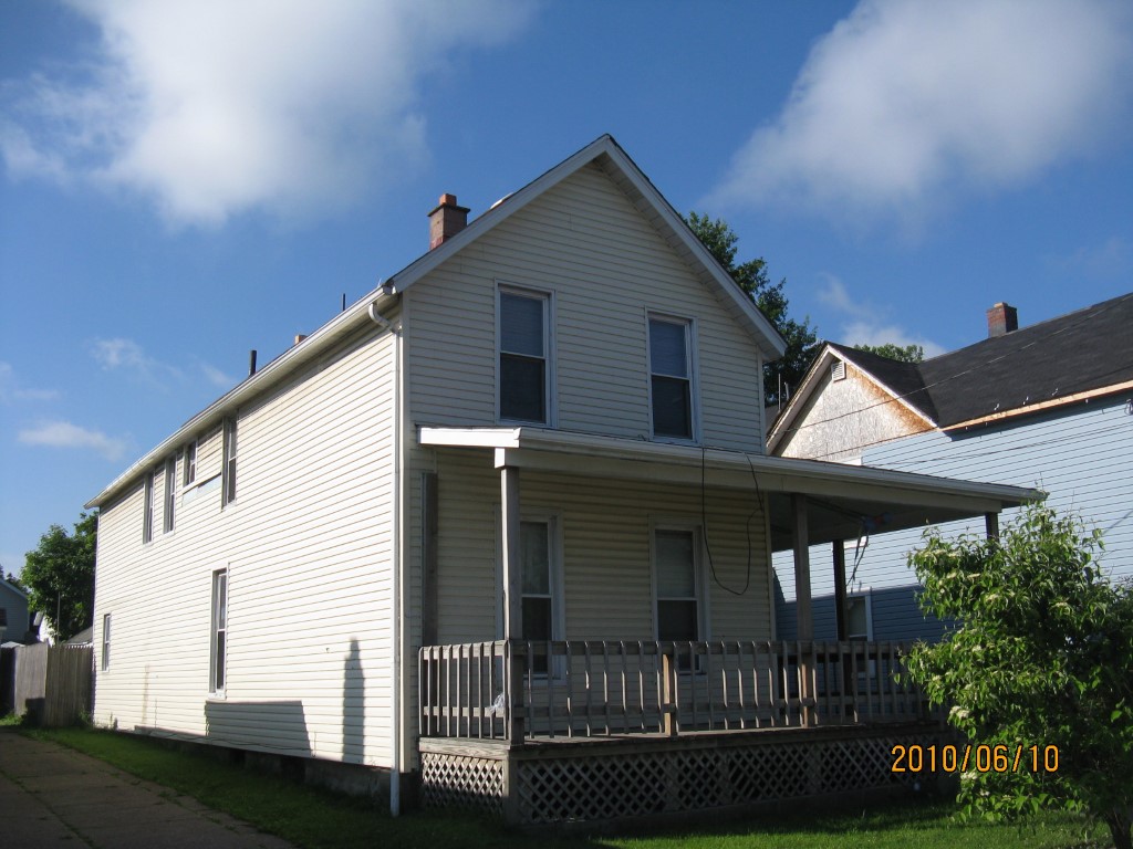
Address: 623 E 12 ST
Parcel: 15020033031000
Parcel Profile
Address
623 | E | 12 | ST
Street Status
PAVED | SIDEWALK
School District
CITY OF ERIE SCHOOL
Acreage
0.0964
Classification
A
Land Use Code
APARTMENTS 4 - 19 UNITS
Legal Description
623 E 12 ST 40 X 105
Square Feet
3456
Topo
LEVEL
Utility
ALL PUBLIC
Zoning
Please contact your municipal zoning officer
Deed Book
2024
Deed Page
006035
2026 Tax Values
Land Value / Taxable
5,300 / 5,300.00
Building Value / Taxable
40,100 / 40,100.00
Total Value / Taxable
45,400 / 45,400.00
Clean & Green
Inactive
Homestead Status
Inactive
Farmstead Status
Inactive
Lerta Amount
0
Lerta Expiration Year
0
Commercial Data
Card 1
RESIDENTIAL 4 FAMILY
Business Living Area - 3456
Year Built - 1892
Improvement Name - APARTMENTS
Value - 39930
Other Buildings & Yards
No OBY Data Found
Sales History
Sale Date
Type
Price
Book / Page
Other Info
4/23/2024
LAND & BUILDING
0
2024 / 006035
SPECIAL WARRANTY DEED
9/22/2005
LAND & BUILDING
880000
1271 / 2333
WARRANTY/SURVIVORSHIP DEED
3/10/1995
7000
0375 / 1040
5/5/1992
0
0210 / 0423
1/20/1955
0
0692 / 0560
1/26/1944
0
0443 / 0369
11/26/1943
0
0443 / 0171
2/10/1941
0
0404 / 0282
Parcel Sketches
Commercial Card 1
A
MAIN
1152 square feet
B
MAIN
1152 square feet
C
MAIN
1152 square feet
Parcel Images
Please note:
this tab is for informational purposes only and may not show all delinquencies, see the Taxes tab for more accurate delinquent taxes due.