Elected Officials
Courts
Departments
Initiatives
Open Government
About
Login / Register
Home
/
Property & Tax Records
/
Property Records
/
Property & Tax Search
/
Parcel Profile
/
Print View
Search for Another Parcel
Parcel Profile
Historical Card
Sketches
Photos
Tax Map
Taxes
Print View
Print This Page
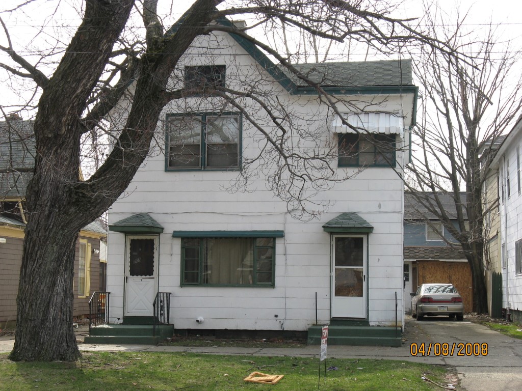
Address: 705 E 10 ST
Parcel: 15020035022100
Parcel Profile
Address
705 | E | 10 | ST
Street Status
PAVED | SIDEWALK
School District
CITY OF ERIE SCHOOL
Acreage
0.0861
Classification
R
Land Use Code
THREE FAMILY
Legal Description
705 E 10 ST 37.5 X 100
Square Feet
2560
Topo
LEVEL
Utility
ALL PUBLIC
Zoning
Please contact your municipal zoning officer
Deed Book
1412
Deed Page
0700
2026 Tax Values
Land Value / Taxable
5,800 / 5,800.00
Building Value / Taxable
37,100 / 37,100.00
Total Value / Taxable
42,900 / 42,900.00
Clean & Green
Inactive
Homestead Status
Inactive
Farmstead Status
Inactive
Lerta Amount
0
Lerta Expiration Year
0
Residential Data
Card 1
Style
OLD STYLE
Basement
FULL
Year Built
1900
Exterior Wall
COMPOSITION
Total Living Area
2560
Full Baths
3
Half Baths
1
Fuel Type
GAS
Heating
CENTRAL
Heating System
FORCED AIR
Stories
2.0
Total Bedrooms
5
Total Family Rooms
0
Total Rooms
14
Fireplaces
0
Other Buildings & Yards
Description
Built
Width
Length
Area
FRAME OR CB DETACHED GARAGE
1900
18
20
360
Sales History
Sale Date
Type
Price
Book / Page
Other Info
4/30/2007
LAND & BUILDING
0
1412 / 0700
QUIT CLAIM DEED
5/30/2001
0
0778 / 1655
2/22/1995
0
0373 / 1800
2/22/1995
20000
0373 / 1803
6/17/1985
28000
1584 / 0016
8/7/1972
21000
1075 / 0420
8/1/1966
0
0945 / 0182
9/25/1964
0
0904 / 0141
Parcel Sketches
Residential Card 1
A
MAIN
1176 square feet
B
EFP ENCL FRAME PORCH
42 square feet
C
1S FR ONE STORY FRAME
208 square feet
D
OFP OPEN FRAME PORCH
72 square feet
E
MA STOOP/TERR MAS STOOP
28 square feet
F
MA STOOP/TERR MAS STOOP
24 square feet
Parcel Images
Please note:
this tab is for informational purposes only and may not show all delinquencies, see the Taxes tab for more accurate delinquent taxes due.