Elected Officials
Courts
Departments
Initiatives
Open Government
About
Login / Register
Home
/
Property & Tax Records
/
Property Records
/
Property & Tax Search
/
Parcel Profile
/
Print View
Search for Another Parcel
Parcel Profile
Historical Card
Sketches
Photos
Tax Map
Taxes
Print View
Print This Page
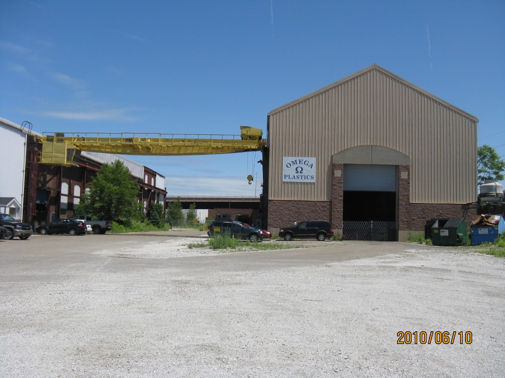
Address: 1507 WAYNE ST
Parcel: 15020040011000
Parcel Profile
Address
1507 | WAYNE | ST
School District
CITY OF ERIE SCHOOL
Acreage
2.1620
Classification
I
Land Use Code
LIGHT INDUSTRIAL
Legal Description
1507 WAYNE ST LOT 1 | 2.162 AC NET
Square Feet
26130
Zoning
Please contact your municipal zoning officer
Deed Book
2024
Deed Page
011039
2026 Tax Values
Land Value / Taxable
54,100 / 54,100.00
Building Value / Taxable
247,500 / 247,500.00
Total Value / Taxable
301,600 / 301,600.00
Clean & Green
Inactive
Homestead Status
Inactive
Farmstead Status
Inactive
Lerta Amount
0
Lerta Expiration Year
0
Commercial Data
Card 1
MFG/PROCESSING
Business Living Area - 26130
Year Built - 1910
Improvement Name - OMEGA PLASTICS
Value - 247520
Other Buildings & Yards
No OBY Data Found
Sales History
Sale Date
Type
Price
Book / Page
Other Info
7/17/2024
LAND & BUILDING
474000
2024 / 011039
SPECIAL WARRANTY DEED
11/6/2007
0
1458 / 0619
9/17/2007
LAND & BUILDING
0
1447 / 0618
DEED
9/17/2007
LAND & BUILDING
0
1447 / 0649
DEED
12/21/2006
LAND & BUILDING
305000
1384 / 1769
DEED
3/21/1997
0
0488 / 2264
Parcel Sketches
Commercial Card 1
A
MAIN
26130 square feet
Parcel Images
Please note:
this tab is for informational purposes only and may not show all delinquencies, see the Taxes tab for more accurate delinquent taxes due.