Elected Officials
Courts
Departments
Initiatives
Open Government
About
Login / Register
Home
/
Property & Tax Records
/
Property Records
/
Property & Tax Search
/
Parcel Profile
/
Print View
Search for Another Parcel
Parcel Profile
Historical Card
Sketches
Photos
Tax Map
Taxes
Print View
Print This Page
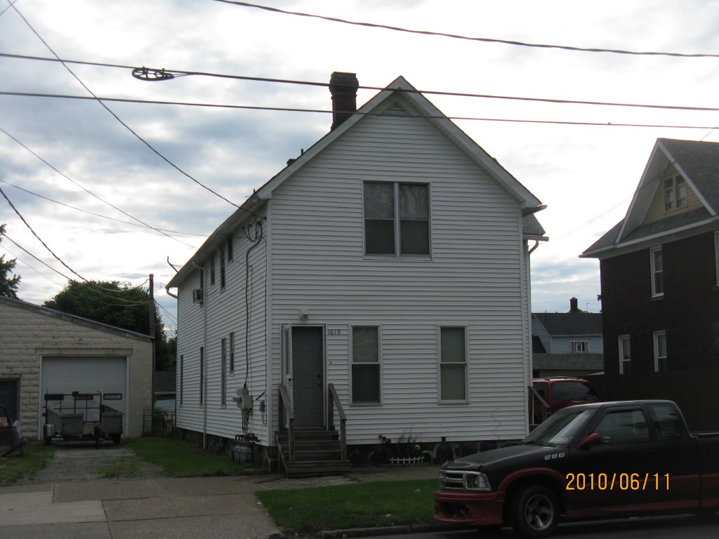
Address: 1019 EAST AVE
Parcel: 15020046022200
Parcel Profile
Address
1019 | EAST | AVE
Street Status
PAVED
School District
CITY OF ERIE SCHOOL
Acreage
0.1121
Classification
A
Land Use Code
APARTMENTS 4 - 19 UNITS
Legal Description
1019 EAST AVE 41.25X118.36
Square Feet
6186
Topo
LEVEL
Utility
ALL PUBLIC
Zoning
Please contact your municipal zoning officer
Deed Book
2022
Deed Page
010500
2026 Tax Values
Land Value / Taxable
6,100 / 6,100.00
Building Value / Taxable
29,450 / 29,450.00
Total Value / Taxable
35,550 / 35,550.00
Clean & Green
Inactive
Homestead Status
Inactive
Farmstead Status
Inactive
Lerta Amount
0
Lerta Expiration Year
0
Commercial Data
Card 1
RESIDENTIAL 4 FAMILY
Business Living Area - 3834
Year Built - 1890
Improvement Name - APARTMENTS
Value - 38860
Card 2
RESIDENTIAL 1 FAMILY
Business Living Area - 2352
Year Built - 1910
Improvement Name - REAR APT BLDG.
Value - 27190
Other Buildings & Yards
Description
Built
Width
Length
Area
PAVING ASPHALT/CONCRETE
1970
12
40
480
Sales History
Sale Date
Type
Price
Book / Page
Other Info
5/17/2022
LAND & BUILDING
0
2022 / 010500
SPECIAL WARRANTY DEED
6/19/2019
LAND & BUILDING
44000
2019 / 011579
SPECIAL WARRANTY DEED
6/19/2019
LAND & BUILDING
0
2019 / 011578
QUIT CLAIM DEED
9/25/1995
0
0404 / 2271
Parcel Sketches
Commercial Card 1
A
MAIN
1278 square feet
B
MAIN
1278 square feet
C
MAIN
1278 square feet
Commercial Card 2
A
MAIN
784 square feet
B
MAIN
784 square feet
C
MAIN
784 square feet
Parcel Images
Please note:
this tab is for informational purposes only and may not show all delinquencies, see the Taxes tab for more accurate delinquent taxes due.