Elected Officials
Courts
Departments
Initiatives
Open Government
About
Login / Register
Home
/
Property & Tax Records
/
Property Records
/
Property & Tax Search
/
Parcel Profile
/
Print View
Search for Another Parcel
Parcel Profile
Historical Card
Sketches
Photos
Tax Map
Taxes
Print View
Print This Page
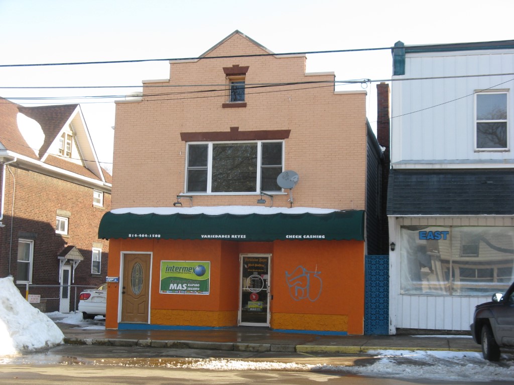
Address: 1027 EAST AVE
Parcel: 15020046022400
Parcel Profile
Address
1027 | EAST | AVE
Street Status
PAVED | SIDEWALK
School District
CITY OF ERIE SCHOOL
Acreage
0.0951
Classification
C
Land Use Code
RESTAURANTS, STORES (RETAIL)
Legal Description
1027 EAST AVE 35X118.36
Square Feet
2700
Topo
LEVEL
Utility
ALL PUBLIC
Zoning
Please contact your municipal zoning officer
Deed Book
1497
Deed Page
2132
2026 Tax Values
Land Value / Taxable
6,200 / 6,200.00
Building Value / Taxable
43,400 / 43,400.00
Total Value / Taxable
49,600 / 49,600.00
Clean & Green
Inactive
Homestead Status
Inactive
Farmstead Status
Inactive
Lerta Amount
0
Lerta Expiration Year
0
Commercial Data
Card 1
MIXED RES/COMM
Business Living Area - 2700
Year Built - 1888
Improvement Name - VARIEDADES REYES CHECK CASHING
Value - 43420
Other Buildings & Yards
No OBY Data Found
Sales History
Sale Date
Type
Price
Book / Page
Other Info
5/29/2008
LAND & BUILDING
40000
1497 / 2132
SPECIAL WARRANTY DEED
9/25/1996
0
0463 / 0174
Parcel Sketches
Commercial Card 1
A
MAIN
1350 square feet
B
MAIN
1350 square feet
C
MAIN
1350 square feet
Parcel Images
Please note:
this tab is for informational purposes only and may not show all delinquencies, see the Taxes tab for more accurate delinquent taxes due.