Elected Officials
Courts
Departments
Initiatives
Open Government
About
Login / Register
Home
/
Property & Tax Records
/
Property Records
/
Property & Tax Search
/
Parcel Profile
/
Print View
Search for Another Parcel
Parcel Profile
Historical Card
Sketches
Photos
Tax Map
Taxes
Print View
Print This Page
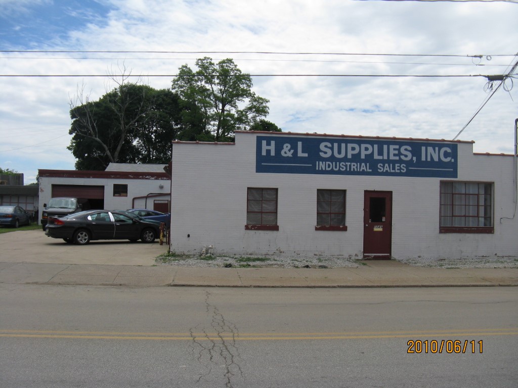
Address: 1049 E 20 ST
Parcel: 15020053010300
Parcel Profile
Address
1049 | E | 20 | ST
Street Status
PAVED
School District
CITY OF ERIE SCHOOL
Acreage
0.1928
Classification
C
Land Use Code
WAREHOUSES
Legal Description
1049 E 20 ST 80X105
Square Feet
5252
Topo
LEVEL
Utility
ALL PUBLIC
Zoning
Please contact your municipal zoning officer
Deed Book
0384
Deed Page
1801
2026 Tax Values
Land Value / Taxable
12,600 / 12,600.00
Building Value / Taxable
46,100 / 46,100.00
Total Value / Taxable
58,700 / 58,700.00
Clean & Green
Inactive
Homestead Status
Inactive
Farmstead Status
Inactive
Lerta Amount
0
Lerta Expiration Year
0
Commercial Data
Card 1
WAREHOUSE
Business Living Area - 5252
Year Built - 1952
Improvement Name - PERRY SCREW MACHINE CO.
Value - 46100
Other Buildings & Yards
No OBY Data Found
Sales History
Sale Date
Type
Price
Book / Page
Other Info
5/23/1995
0
0384 / 1801
Parcel Sketches
Commercial Card 1
A
MAIN
5252 square feet
Parcel Images
Please note:
this tab is for informational purposes only and may not show all delinquencies, see the Taxes tab for more accurate delinquent taxes due.