Elected Officials
Courts
Departments
Initiatives
Open Government
About
Login / Register
Home
/
Property & Tax Records
/
Property Records
/
Property & Tax Search
/
Parcel Profile
/
Print View
Search for Another Parcel
Parcel Profile
Historical Card
Sketches
Photos
Tax Map
Taxes
Print View
Print This Page
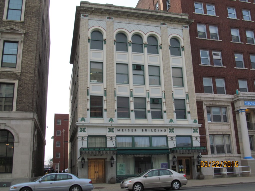
Address: 21 23 W 10 ST
Parcel: 16030004021400
Parcel Profile
Address
21 | 23 | W | 10 | ST
Street Status
PAVED | SIDEWALK
School District
CITY OF ERIE SCHOOL
Acreage
0.1550
Classification
C
Land Use Code
OFFICE BLDGS/LABS/LIBRARIES
Legal Description
21 23 W 10 ST 45 X 150
Square Feet
13248
Topo
LEVEL
Utility
ALL PUBLIC
Zoning
Please contact your municipal zoning officer
Deed Book
2019
Deed Page
012305
2026 Tax Values
Land Value / Taxable
47,300 / 47,300.00
Building Value / Taxable
277,900 / 277,900.00
Total Value / Taxable
325,200 / 325,200.00
Clean & Green
Inactive
Homestead Status
Inactive
Farmstead Status
Inactive
Lerta Amount
0
Lerta Expiration Year
0
Commercial Data
Card 1
OFFICE BLDG L/R 1-4S
Business Living Area - 13248
Year Built - 1925
Improvement Name - MEISER BUILDING
Value - 280040
Other Buildings & Yards
No OBY Data Found
Sales History
Sale Date
Type
Price
Book / Page
Other Info
6/28/2019
LAND & BUILDING
515000
2019 / 012305
SPECIAL WARRANTY DEED
10/20/2008
LAND & BUILDING
0
1526 / 2178
CORRECTIVE DEED
10/20/2008
LAND & BUILDING
190000
1526 / 2182
DEED
2/3/1988
0
0041 / 0037
3/3/1958
0
0773 / 0038
3/2/1942
0
0414 / 0572
Parcel Sketches
Commercial Card 1
A
MAIN
3312 square feet
B
MAIN
1672 square feet
C
MAIN
1640 square feet
D
MAIN
3312 square feet
Parcel Images
Please note:
this tab is for informational purposes only and may not show all delinquencies, see the Taxes tab for more accurate delinquent taxes due.