Elected Officials
Courts
Departments
Initiatives
Open Government
About
Login / Register
Home
/
Property & Tax Records
/
Property Records
/
Property & Tax Search
/
Parcel Profile
/
Print View
Search for Another Parcel
Parcel Profile
Historical Card
Sketches
Photos
Tax Map
Taxes
Print View
Print This Page
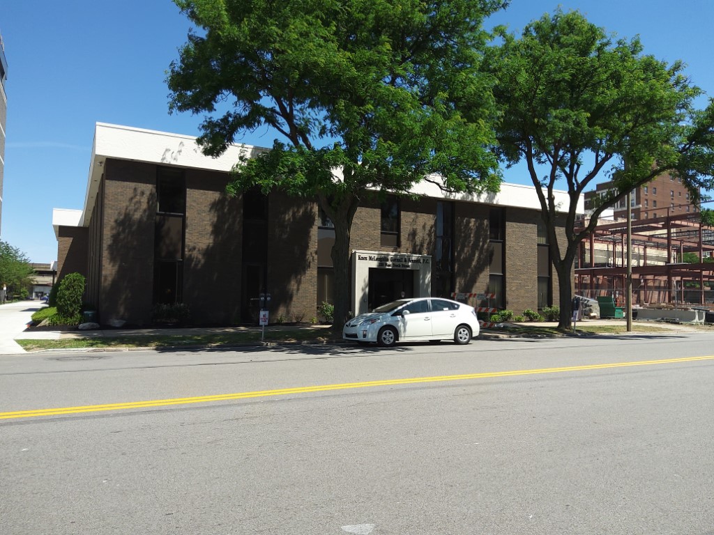
Address: 120 W 10 ST
Parcel: 16030010012000
Parcel Profile
Address
120 | W | 10 | ST
Street Status
PAVED | SIDEWALK
School District
CITY OF ERIE SCHOOL
Acreage
0.6250
Classification
C
Land Use Code
OFFICE BLDGS/LABS/LIBRARIES
Legal Description
120 W 10 ST 165 X 165 IRREG | 0.6250 AC
Square Feet
27585
Topo
LEVEL
Utility
ALL PUBLIC
Zoning
Please contact your municipal zoning officer
Deed Book
2019
Deed Page
014245
2026 Tax Values
Land Value / Taxable
163,400 / 163,400.00
Building Value / Taxable
817,800 / 776,500.00
Total Value / Taxable
981,200 / 939,900.00
Clean & Green
Inactive
Homestead Status
Inactive
Farmstead Status
Inactive
Lerta Amount
0
Lerta Expiration Year
0
Commercial Data
Card 1
OFFICE BLDG L/R 1-4S
Business Living Area - 27585
Year Built - 1978
Improvement Name - LAW OFFICES KNOX
Value - 1317730
Other Buildings & Yards
Description
Built
Width
Length
Area
PAVING ASPHALT PARKING
2021
0
0
13165
SOUND VALUE OF MISC. STRUCTURE
1926
0
0
27585
Sales History
Sale Date
Type
Price
Book / Page
Other Info
7/24/2019
LAND & BUILDING
0
2019 / 014245
QUIT CLAIM DEED
8/24/2006
LAND & BUILDING
0
1355 / 0375
QUIT CLAIM DEED
Parcel Sketches
Commercial Card 1
A
MAIN
7687 square feet
B
MAIN
9949 square feet
C
MAIN
9949 square feet
Parcel Images
Please note:
this tab is for informational purposes only and may not show all delinquencies, see the Taxes tab for more accurate delinquent taxes due.