Elected Officials
Courts
Departments
Initiatives
Open Government
About
Login / Register
Home
/
Property & Tax Records
/
Property Records
/
Property & Tax Search
/
Parcel Profile
/
Print View
Search for Another Parcel
Parcel Profile
Historical Card
Sketches
Photos
Tax Map
Taxes
Print View
Print This Page
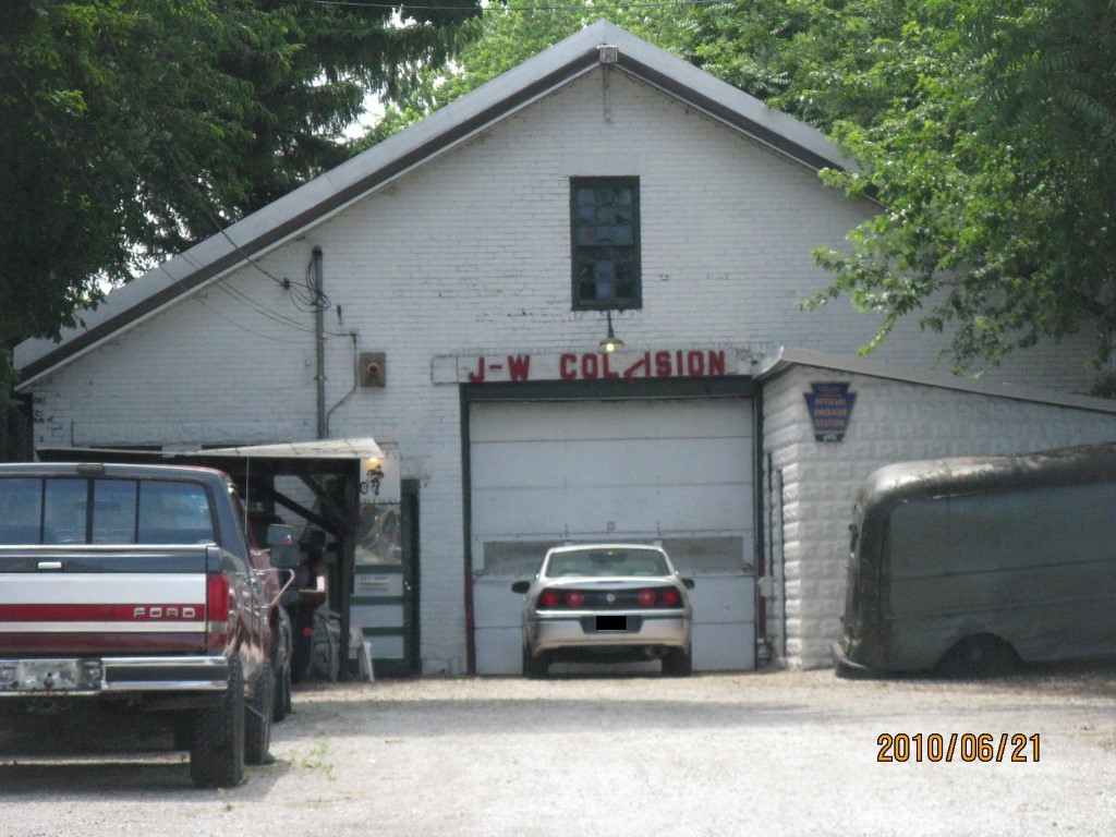
Address: 1616 SASSAFRAS ST
Parcel: 16030011030300
Parcel Profile
Address
1616 | SASSAFRAS | ST
Street Status
PAVED | SIDEWALK
School District
CITY OF ERIE SCHOOL
Acreage
0.3333
Classification
C
Land Use Code
GARAGES/SHOP/CAR DEALERS
Legal Description
1616 SASSAFRAS ST 44X330
Square Feet
4440
Topo
LEVEL
Utility
ALL PUBLIC
Zoning
Please contact your municipal zoning officer
Deed Book
1575
Deed Page
0367
2026 Tax Values
Land Value / Taxable
29,000 / 29,000.00
Building Value / Taxable
40,400 / 40,400.00
Total Value / Taxable
69,400 / 69,400.00
Clean & Green
Inactive
Homestead Status
Inactive
Farmstead Status
Inactive
Lerta Amount
0
Lerta Expiration Year
0
Commercial Data
Card 1
WAREHOUSE
Business Living Area - 4440
Year Built - 1923
Improvement Name - J & W COLLISON
Value - 31250
Other Buildings & Yards
Description
Built
Width
Length
Area
CANOPY ONLY
1975
10
14
140
Sales History
Sale Date
Type
Price
Book / Page
Other Info
4/12/1985
0
1575 / 0367
Parcel Sketches
Commercial Card 1
A
MAIN
4440 square feet
Parcel Images
Please note:
this tab is for informational purposes only and may not show all delinquencies, see the Taxes tab for more accurate delinquent taxes due.