Elected Officials
Courts
Departments
Initiatives
Open Government
About
Login / Register
Home
/
Property & Tax Records
/
Property Records
/
Property & Tax Search
/
Parcel Profile
/
Print View
Search for Another Parcel
Parcel Profile
Historical Card
Sketches
Photos
Tax Map
Taxes
Print View
Print This Page
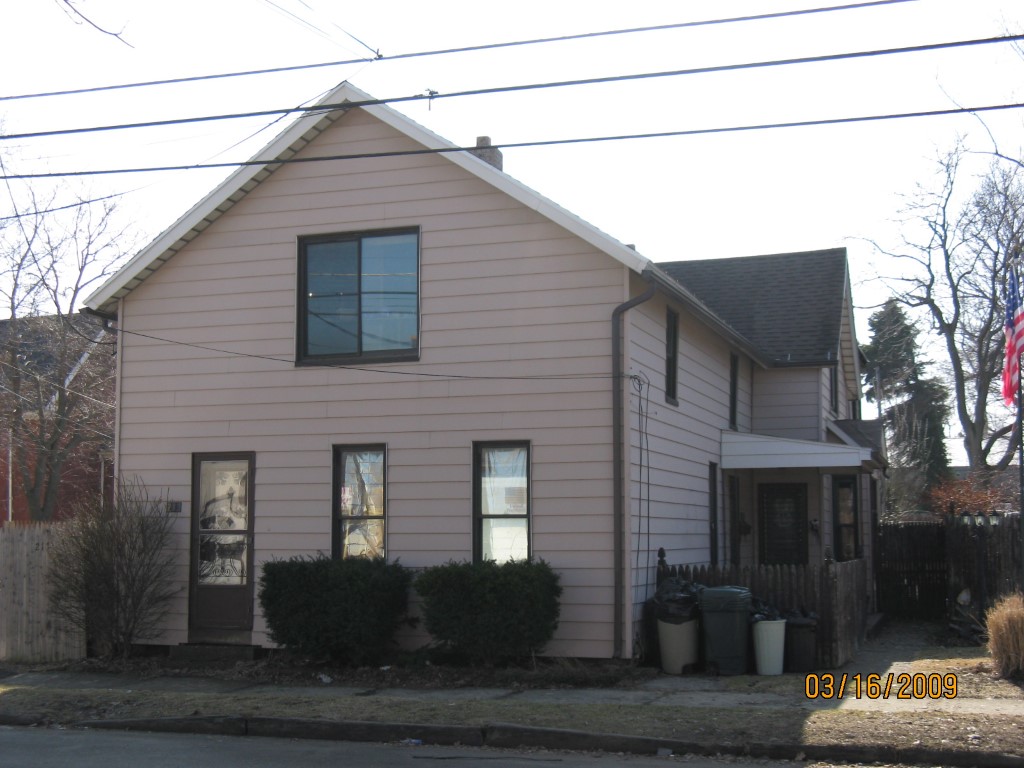
Address: 213 W 16 ST
Parcel: 16030011030700
Parcel Profile
Address
213 | W | 16 | ST
Street Status
PAVED
School District
CITY OF ERIE SCHOOL
Acreage
0.0594
Classification
R
Land Use Code
TWO FAMILY
Legal Description
213 W 16 ST 37.5X69
Square Feet
2370
Topo
LEVEL
Utility
ALL PUBLIC
Zoning
Please contact your municipal zoning officer
Deed Book
0518
Deed Page
2205
2026 Tax Values
Land Value / Taxable
7,800 / 7,800.00
Building Value / Taxable
36,260 / 36,260.00
Total Value / Taxable
44,060 / 44,060.00
Clean & Green
Inactive
Homestead Status
Active
Farmstead Status
Inactive
Lerta Amount
0
Lerta Expiration Year
0
Residential Data
Card 1
Style
OLD STYLE
Basement
FULL
Year Built
1882
Exterior Wall
ALUMINUM/VINYL
Total Living Area
2370
Full Baths
2
Half Baths
0
Fuel Type
GAS
Heating
CENTRAL
Heating System
FORCED AIR
Stories
1.5
Total Bedrooms
4
Total Family Rooms
0
Total Rooms
8
Fireplaces
0
Other Buildings & Yards
No OBY Data Found
Sales History
Sale Date
Type
Price
Book / Page
Other Info
9/16/1997
0
0518 / 2205
Parcel Sketches
Residential Card 1
A
MAIN
1076 square feet
B
UNFIN BSMT BASEMENT UNFINISHED 1S FR ONE STORY FRAME AT FN ATTIC-FINISHED
338 square feet
C
FROVR FRAME OVERHANG
14 square feet
D
OFP OPEN FRAME PORCH
96 square feet
Parcel Images
Please note:
this tab is for informational purposes only and may not show all delinquencies, see the Taxes tab for more accurate delinquent taxes due.