Elected Officials
Courts
Departments
Initiatives
Open Government
About
Login / Register
Home
/
Property & Tax Records
/
Property Records
/
Property & Tax Search
/
Parcel Profile
/
Print View
Search for Another Parcel
Parcel Profile
Historical Card
Sketches
Photos
Tax Map
Taxes
Print View
Print This Page
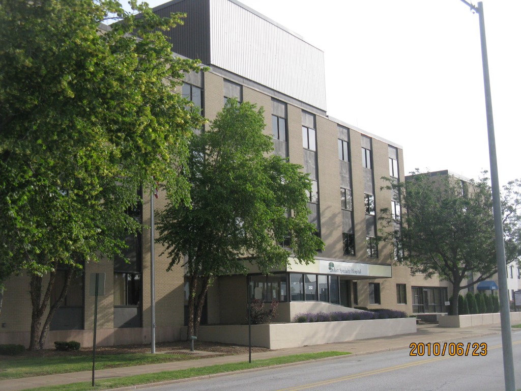
Address: 252 W 11 ST
Parcel: 16030014020600
Parcel Profile
Address
252 | W | 11 | ST
Street Status
PAVED
School District
CITY OF ERIE SCHOOL
Acreage
1.9440
Classification
C
Land Use Code
COMMERCIAL COMMON AREA
Legal Description
239 W 11 ST 1.944 AC | REF 2005-82 & 2006-52
Square Feet
149921
Topo
LEVEL
Utility
ALL PUBLIC
Zoning
Please contact your municipal zoning officer
Deed Book
1226
Deed Page
2113
2026 Tax Values
Land Value / Taxable
0 / 0.00
Building Value / Taxable
0 / 0.00
Total Value / Taxable
0 / 0.00
Clean & Green
Inactive
Homestead Status
Inactive
Farmstead Status
Inactive
Lerta Amount
0.00
Lerta Expiration Year
0
Commercial Data
Card 1
CONDO COMMON ELEMENT
Business Living Area - 149921
Year Built - 1960
Improvement Name - METRO HEALTH CENTER
Value - 10707480
Other Buildings & Yards
Description
Built
Width
Length
Area
SPRINKLER W/S
1990
0
0
155334
PAVING ASPHALT PARKING
1990
0
0
14800
Sales History
Sale Date
Type
Price
Book / Page
Other Info
4/19/2005
LAND & BUILDING
0
1226 / 2113
DEED
Parcel Sketches
Commercial Card 1
A
MAIN
34600 square feet
B
MAIN
35964 square feet
C
MAIN
26652 square feet
D
MAIN
27050 square feet
E
MAIN
22667 square feet
F
MAIN
2988 square feet
Parcel Images
Please note:
this tab is for informational purposes only and may not show all delinquencies, see the Taxes tab for more accurate delinquent taxes due.