Elected Officials
Courts
Departments
Initiatives
Open Government
About
Login / Register
Home
/
Property & Tax Records
/
Property Records
/
Property & Tax Search
/
Parcel Profile
/
Print View
Search for Another Parcel
Parcel Profile
Historical Card
Sketches
Photos
Tax Map
Taxes
Print View
Print This Page
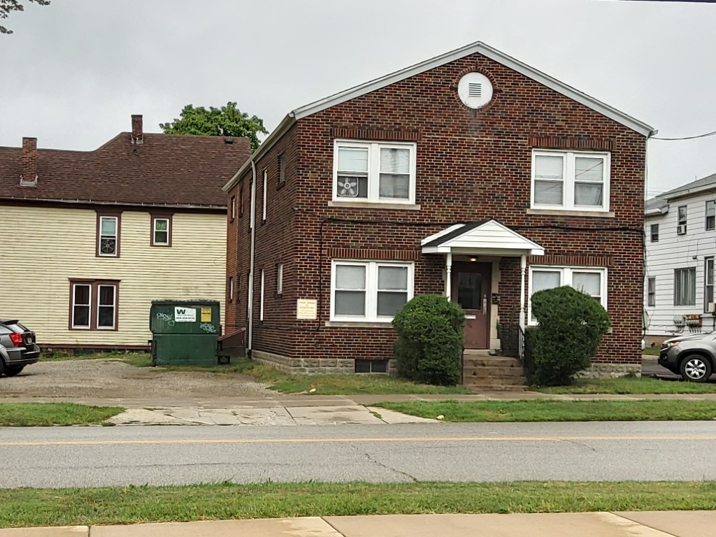
Address: 260 64 W 9 ST
Parcel: 16030015021800
Parcel Profile
Address
260 | 64 | W | 9 | ST
Street Status
PAVED | SIDEWALK
School District
CITY OF ERIE SCHOOL
Acreage
0.1697
Classification
A
Land Use Code
APARTMENTS 4 - 19 UNITS
Legal Description
260 64 W 9 ST 67 X IRREG
Square Feet
3080
Topo
LEVEL
Utility
ALL PUBLIC
Zoning
Please contact your municipal zoning officer
Deed Book
2024
Deed Page
006168
2026 Tax Values
Land Value / Taxable
8,900 / 8,900.00
Building Value / Taxable
161,207 / 161,207.00
Total Value / Taxable
170,107 / 170,107.00
Clean & Green
Inactive
Homestead Status
Inactive
Farmstead Status
Inactive
Lerta Amount
0
Lerta Expiration Year
0
Commercial Data
Card 1
RESIDENTIAL 4 FAMILY
Business Living Area - 3080
Year Built - 1940
Improvement Name - APARTMENTS
Value - 66010
Other Buildings & Yards
Description
Built
Width
Length
Area
FLAT BARN
1940
0
0
884
PAVING ASPHALT PARKING
1980
0
0
2500
Sales History
Sale Date
Type
Price
Book / Page
Other Info
4/26/2024
LAND & BUILDING
212000
2024 / 006168
SPECIAL WARRANTY DEED
6/5/2020
LAND & BUILDING
379500
2020 / 009947
SPECIAL WARRANTY DEED
7/18/2018
LAND & BUILDING
180000
2018 / 014303
SPECIAL WARRANTY DEED
5/6/2015
LAND & BUILDING
0
2015 / 008894
WARRANTY/SURVIVORSHIP DEED
5/6/2015
LAND & BUILDING
60000
2015 / 008893
WARRANTY/SURVIVORSHIP DEED
1/15/1999
LAND & BUILDING
160000
612 / 1460
Parcel Sketches
Commercial Card 1
A
MAIN
1540 square feet
B
MAIN
1540 square feet
C
MAIN
1540 square feet
Parcel Images
Please note:
this tab is for informational purposes only and may not show all delinquencies, see the Taxes tab for more accurate delinquent taxes due.