Elected Officials
Courts
Departments
Initiatives
Open Government
About
Login / Register
Home
/
Property & Tax Records
/
Property Records
/
Property & Tax Search
/
Parcel Profile
/
Print View
Search for Another Parcel
Parcel Profile
Historical Card
Sketches
Photos
Tax Map
Taxes
Print View
Print This Page
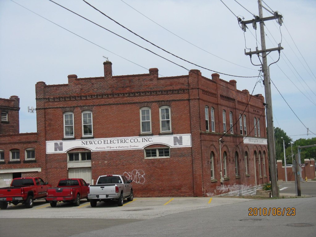
Address: 301 W 12 ST
Parcel: 16030018020200
Parcel Profile
Address
301 | W | 12 | ST
Street Status
PAVED | SIDEWALK
School District
CITY OF ERIE SCHOOL
Acreage
0.3009
Classification
C
Land Use Code
WAREHOUSES
Legal Description
301 W 12 ST 13,108 SQ FT
Square Feet
14560
Topo
LEVEL
Utility
ALL PUBLIC
Zoning
Please contact your municipal zoning officer
Deed Book
2022
Deed Page
023580
2026 Tax Values
Land Value / Taxable
65,500 / 65,500.00
Building Value / Taxable
200,300 / 200,300.00
Total Value / Taxable
265,800 / 265,800.00
Clean & Green
Inactive
Homestead Status
Inactive
Farmstead Status
Inactive
Lerta Amount
0
Lerta Expiration Year
0
Commercial Data
Card 1
WAREHOUSE
Business Living Area - 14560
Year Built - 1898
Improvement Name - NEWCO ELECTRIC
Value - 278290
Other Buildings & Yards
No OBY Data Found
Sales History
Sale Date
Type
Price
Book / Page
Other Info
11/1/2022
LAND & BUILDING
145000
2022 / 023580
FIDUCIARY DEED
9/12/2013
LAND & BUILDING
0
2013 / 024374
QUIT CLAIM DEED
7/31/1998
0
0578 / 0184
Parcel Sketches
Commercial Card 1
A
MAIN
2688 square feet
B
MAIN
2688 square feet
C
MAIN
3200 square feet
D
MAIN
2992 square feet
E
MAIN
2992 square feet
Parcel Images
Please note:
this tab is for informational purposes only and may not show all delinquencies, see the Taxes tab for more accurate delinquent taxes due.