Elected Officials
Courts
Departments
Initiatives
Open Government
About
Login / Register
Home
/
Property & Tax Records
/
Property Records
/
Property & Tax Search
/
Parcel Profile
/
Print View
Search for Another Parcel
Parcel Profile
Historical Card
Sketches
Photos
Tax Map
Taxes
Print View
Print This Page
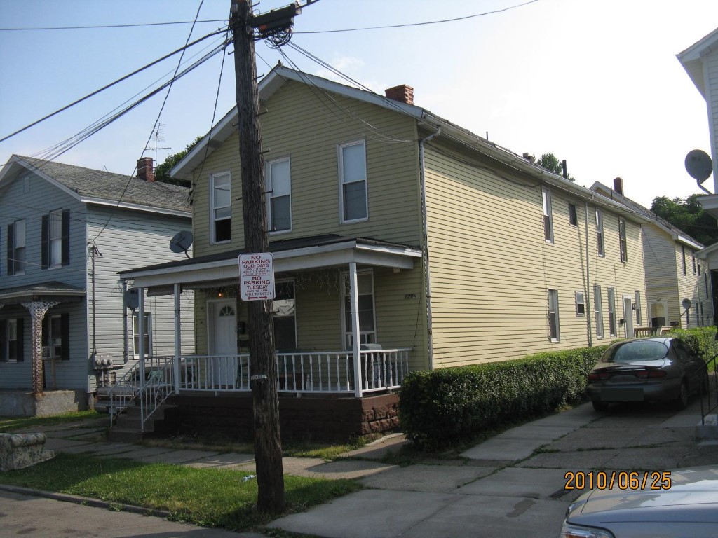
Address: 1709 WALNUT ST
Parcel: 16030021012000
Parcel Profile
Address
1709 | WALNUT | ST
Street Status
PAVED | SIDEWALK
School District
CITY OF ERIE SCHOOL
Acreage
0.1000
Classification
A
Land Use Code
APARTMENTS 4 - 19 UNITS
Legal Description
1709 WALNUT ST 33.5 X 130
Square Feet
6534
Topo
LEVEL
Utility
ALL PUBLIC
Zoning
Please contact your municipal zoning officer
Deed Book
2022
Deed Page
016859
2026 Tax Values
Land Value / Taxable
6,500 / 6,500.00
Building Value / Taxable
52,700 / 52,700.00
Total Value / Taxable
59,200 / 59,200.00
Clean & Green
Inactive
Homestead Status
Inactive
Farmstead Status
Inactive
Lerta Amount
0
Lerta Expiration Year
0
Commercial Data
Card 1
RESIDENTIAL 4 FAMILY
Business Living Area - 4086
Year Built - 1882
Improvement Name - APARTMENTS
Value - 40240
Card 2
RESIDENTIAL 2 FAMILY
Business Living Area - 2448
Year Built - 1915
Improvement Name - RENTAL HOUSE
Value - 25580
Other Buildings & Yards
No OBY Data Found
Sales History
Sale Date
Type
Price
Book / Page
Other Info
8/3/2022
LAND & BUILDING
170000
2022 / 016859
SPECIAL WARRANTY DEED
3/12/2009
LAND & BUILDING
0
1548 / 1256
QUIT CLAIM DEED
4/28/1995
0
0381 / 1002
Parcel Sketches
Commercial Card 1
A
MAIN
1362 square feet
B
MAIN
1362 square feet
C
MAIN
1362 square feet
Commercial Card 2
A
MAIN
816 square feet
B
MAIN
816 square feet
C
MAIN
816 square feet
D
MAIN
708 square feet
Parcel Images
Please note:
this tab is for informational purposes only and may not show all delinquencies, see the Taxes tab for more accurate delinquent taxes due.