Elected Officials
Courts
Departments
Initiatives
Open Government
About
Login / Register
Home
/
Property & Tax Records
/
Property Records
/
Property & Tax Search
/
Parcel Profile
/
Print View
Search for Another Parcel
Parcel Profile
Historical Card
Sketches
Photos
Tax Map
Taxes
Print View
Print This Page
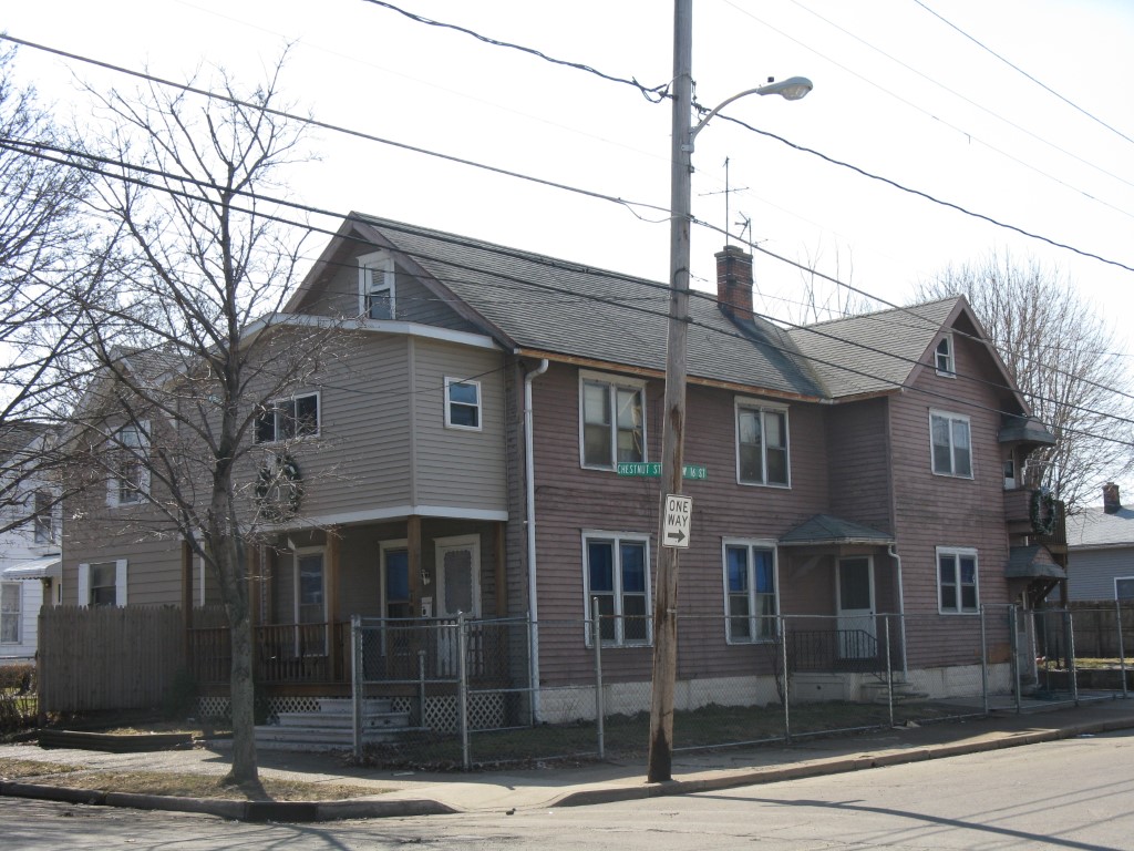
Address: 1602 CHESTNUT ST
Parcel: 16030021020700
Parcel Profile
Address
1602 | CHESTNUT | ST
Street Status
PAVED
School District
CITY OF ERIE SCHOOL
Acreage
0.0904
Classification
R
Land Use Code
TWO FAMILY
Legal Description
1602 CHESTNUT ST 37.5X111.25
Square Feet
2200
Topo
LEVEL
Utility
ALL PUBLIC
Zoning
Please contact your municipal zoning officer
Deed Book
0359
Deed Page
0609
2026 Tax Values
Land Value / Taxable
8,600 / 8,600.00
Building Value / Taxable
47,010 / 47,010.00
Total Value / Taxable
55,610 / 55,610.00
Clean & Green
Inactive
Homestead Status
Active
Farmstead Status
Inactive
Lerta Amount
0
Lerta Expiration Year
0
Residential Data
Card 1
Style
CONVENTIONAL
Basement
FULL
Year Built
1910
Exterior Wall
FRAME
Total Living Area
2200
Full Baths
2
Half Baths
0
Fuel Type
GAS
Heating
CENTRAL
Heating System
HOT WATER
Stories
2.0
Total Bedrooms
3
Total Family Rooms
2
Total Rooms
12
Fireplaces
0
Other Buildings & Yards
No OBY Data Found
Sales History
Sale Date
Type
Price
Book / Page
Other Info
10/21/1994
0
0359 / 0609
Parcel Sketches
Residential Card 1
A
MAIN
1100 square feet
B
OFP OPEN FRAME PORCH EFP ENCL FRAME PORCH
140 square feet
C
MA STOOP/TERR MAS STOOP
48 square feet
D
OFP OPEN FRAME PORCH WDDCK WOOD DECKS
252 square feet
E
OFP OPEN FRAME PORCH
8 square feet
F
OFP OPEN FRAME PORCH
30 square feet
Parcel Images
Please note:
this tab is for informational purposes only and may not show all delinquencies, see the Taxes tab for more accurate delinquent taxes due.