Elected Officials
Courts
Departments
Initiatives
Open Government
About
Login / Register
Home
/
Property & Tax Records
/
Property Records
/
Property & Tax Search
/
Parcel Profile
/
Print View
Search for Another Parcel
Parcel Profile
Historical Card
Sketches
Photos
Tax Map
Taxes
Print View
Print This Page
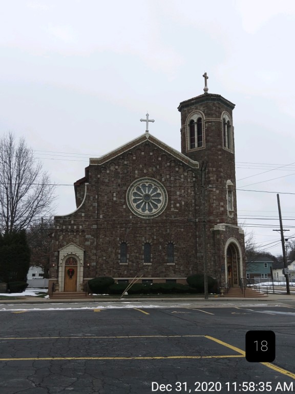
Address: 1617 WALNUT ST
Parcel: 16030021022300
Parcel Profile
Address
1617 | WALNUT | ST
Street Status
PAVED | SIDEWALK
School District
CITY OF ERIE SCHOOL
Acreage
0.4300
Classification
E
Land Use Code
EXEMPT CHURCHES
Legal Description
1617 WALNUT ST 181.5 X 10⁶ IRREG | 0.430 AC
Topo
LEVEL
Utility
ALL PUBLIC
Zoning
Please contact your municipal zoning officer
Deed Book
2025
Deed Page
018267
2026 Tax Values
Land Value / Taxable
28,100 / 28,100.00
Building Value / Taxable
462,300 / 462,300.00
Total Value / Taxable
490,400 / 490,400.00
Clean & Green
Inactive
Homestead Status
Inactive
Farmstead Status
Inactive
Lerta Amount
0
Lerta Expiration Year
0
Other Buildings & Yards
No OBY Data Found
Sales History
Sale Date
Type
Price
Book / Page
Other Info
8/7/2024
LAND & BUILDING
0
2024 / 012317
QUIT CLAIM DEED
2/28/2019
LAND & BUILDING
0
2019 / 003501
QUIT CLAIM DEED
1/1/1969
0
0956 / 0498
Parcel Sketches
Invalid Parcel Number or No Sketches on File
Parcel Images
Please note:
this tab is for informational purposes only and may not show all delinquencies, see the Taxes tab for more accurate delinquent taxes due.