Elected Officials
Courts
Departments
Initiatives
Open Government
About
Login / Register
Home
/
Property & Tax Records
/
Property Records
/
Property & Tax Search
/
Parcel Profile
/
Print View
Search for Another Parcel
Parcel Profile
Historical Card
Sketches
Photos
Tax Map
Taxes
Print View
Print This Page
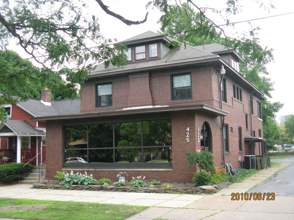
Address: 425 W 10 ST
Parcel: 16030024021200
Parcel Profile
Address
425 | W | 10 | ST
Street Status
PAVED | SIDEWALK
School District
CITY OF ERIE SCHOOL
Acreage
0.3125
Classification
C
Land Use Code
OFFICE BLDGS/LABS/LIBRARIES
Legal Description
425 W 10 ST 82.50 X 165
Square Feet
4860
Topo
LEVEL
Utility
ALL PUBLIC
Zoning
Please contact your municipal zoning officer
Deed Book
2015
Deed Page
027016
2026 Tax Values
Land Value / Taxable
27,200 / 27,200.00
Building Value / Taxable
145,600 / 145,600.00
Total Value / Taxable
172,800 / 172,800.00
Clean & Green
Inactive
Homestead Status
Inactive
Farmstead Status
Inactive
Lerta Amount
0
Lerta Expiration Year
0
Commercial Data
Card 1
MIXED RESIDENTIAL/COMMERCIAL
Business Living Area - 4860
Year Built - 1930
Improvement Name - FAMILY MEDICAL CENTER PC
Value - 134450
Other Buildings & Yards
Description
Built
Width
Length
Area
PAVING ASPHALT PARKING
1970
0
0
2500
Sales History
Sale Date
Type
Price
Book / Page
Other Info
12/11/2015
LAND & BUILDING
175000
2015 / 027016
SPECIAL WARRANTY DEED
7/6/2004
LAND & BUILDING
172500
1151 / 2391
DEED
1/2/1985
0
1565 / 0278
Parcel Sketches
Commercial Card 1
A
MAIN
1380 square feet
B
MAIN
1740 square feet
C
MAIN
1740 square feet
D
MAIN
690 square feet
Parcel Images
Please note:
this tab is for informational purposes only and may not show all delinquencies, see the Taxes tab for more accurate delinquent taxes due.