Elected Officials
Courts
Departments
Initiatives
Open Government
About
Login / Register
Home
/
Property & Tax Records
/
Property Records
/
Property & Tax Search
/
Parcel Profile
/
Print View
Search for Another Parcel
Parcel Profile
Historical Card
Sketches
Photos
Tax Map
Taxes
Print View
Print This Page
Address: 810 12-18 CHESTNUT ST
Parcel: 16030025020400
Parcel Profile
Address
810 | 12-18 | CHESTNUT | ST
Street Status
PAVED | SIDEWALK
School District
CITY OF ERIE SCHOOL
Acreage
0.2147
Classification
A
Land Use Code
APARTMENTS 4 - 19 UNITS
Legal Description
810 12 14 16 18 CHESTNUT ST 88 X 106.28
Square Feet
6595
Topo
LEVEL
Utility
ALL PUBLIC
Zoning
Please contact your municipal zoning officer
Deed Book
2025
Deed Page
006188
2026 Tax Values
Land Value / Taxable
13,300 / 13,300.00
Building Value / Taxable
173,100 / 173,100.00
Total Value / Taxable
186,400 / 186,400.00
Clean & Green
Inactive
Homestead Status
Inactive
Farmstead Status
Inactive
Lerta Amount
0.00
Lerta Expiration Year
2018
Commercial Data
Card 1
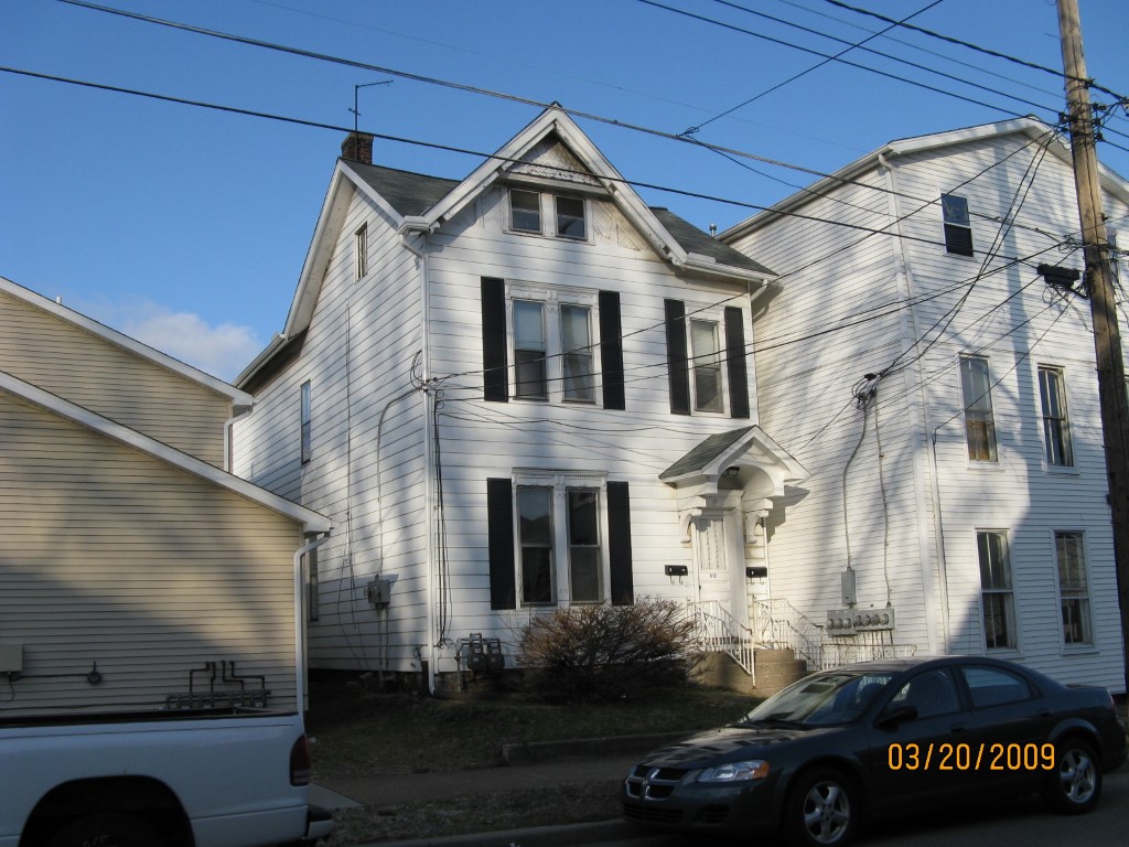
RES STRCT ON APT VAL
Business Living Area - 3180
Year Built - 1873
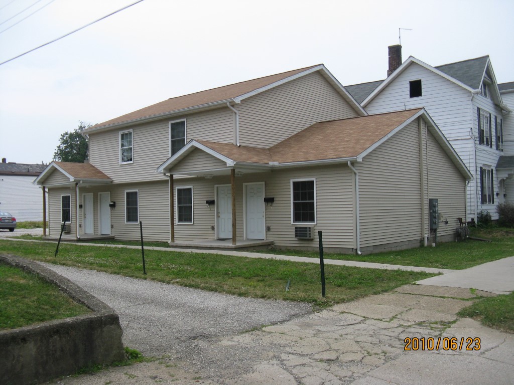
Improvement Name - 810 CHESTNUT
Value - 36220
Card 2
APARTMENTS - GARDEN
Business Living Area - 3415
Year Built - 2007
Improvement Name - 8112-14-16-18 CHESTNUT
Value - 136910
Other Buildings & Yards
No OBY Data Found
Sales History
Sale Date
Type
Price
Book / Page
Other Info
4/21/2025
LAND & BUILDING
1760000
2025 / 006188
SPECIAL WARRANTY DEED
6/27/2007
LAND & BUILDING
0
1427 / 0035
QUIT CLAIM DEED
4/17/2007
LAND & BUILDING
0
1409 / 0462
TAX DEED
8/18/2004
LAND & BUILDING
0
1165 / 0049
QUIT CLAIM DEED
10/9/1972
0
1080 / 0281
Parcel Sketches
Commercial Card 1
A
MAIN
880 square feet
B
MAIN
140 square feet
C
MAIN
880 square feet
D
MAIN
880 square feet
E
MAIN
400 square feet
Commercial Card 2
A
MAIN
2268 square feet
B
MAIN
1147 square feet
Parcel Images
Please note:
this tab is for informational purposes only and may not show all delinquencies, see the Taxes tab for more accurate delinquent taxes due.