Elected Officials
Courts
Departments
Initiatives
Open Government
About
Login / Register
Home
/
Property & Tax Records
/
Property Records
/
Property & Tax Search
/
Parcel Profile
/
Print View
Search for Another Parcel
Parcel Profile
Historical Card
Sketches
Photos
Tax Map
Taxes
Print View
Print This Page
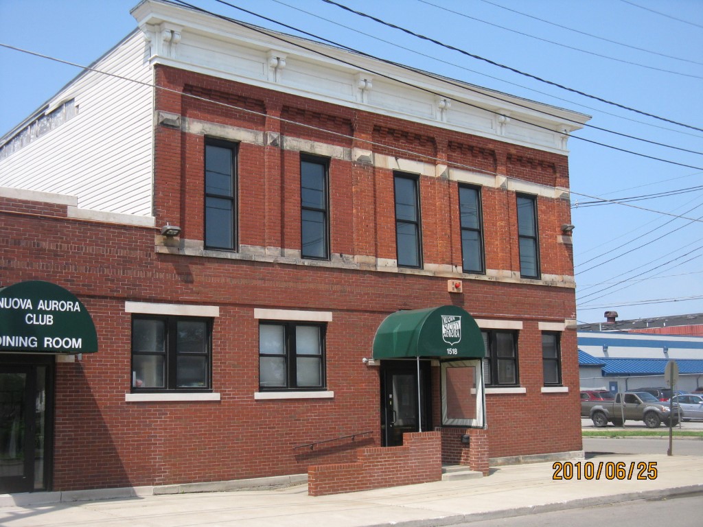
Address: 1518 20 WALNUT ST
Parcel: 16030027010100
Parcel Profile
Address
1518 | 20 | WALNUT | ST
Street Status
PAVED | SIDEWALK
School District
CITY OF ERIE SCHOOL
Acreage
0.3444
Classification
C
Land Use Code
RESTAURANTS, STORES (RETAIL)
Legal Description
1518 20 WALNUT ST 125X120
Square Feet
13918
Topo
LEVEL
Utility
ALL PUBLIC
Zoning
Please contact your municipal zoning officer
Deed Book
0571
Deed Page
0038
2026 Tax Values
Land Value / Taxable
30,000 / 30,000.00
Building Value / Taxable
91,600 / 91,600.00
Total Value / Taxable
121,600 / 121,600.00
Clean & Green
Inactive
Homestead Status
Inactive
Farmstead Status
Inactive
Lerta Amount
0.00
Lerta Expiration Year
2019
Commercial Data
Card 1
RETAIL SINGLE OCCUP
Business Living Area - 13918
Year Built - 1915
Improvement Name - LANUOVA SOCIETY AURORA
Value - 162620
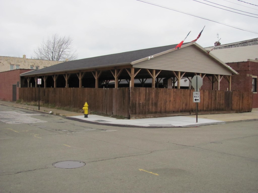
Other Buildings & Yards
Description
Built
Width
Length
Area
CANOPY ONLY
2009
36
66
2376
Sales History
Sale Date
Type
Price
Book / Page
Other Info
7/25/1950
0
0571 / 0038
12/16/1941
0
0415 / 0325
10/7/1939
0
0397 / 0043
3/29/1924
0
281 / 253
Parcel Sketches
Commercial Card 1
A
MAIN
2624 square feet
B
MAIN
2624 square feet
C
MAIN
2624 square feet
D
MAIN
1920 square feet
E
MAIN
1920 square feet
F
MAIN
6750 square feet
Parcel Images
Please note:
this tab is for informational purposes only and may not show all delinquencies, see the Taxes tab for more accurate delinquent taxes due.