Elected Officials
Courts
Departments
Initiatives
Open Government
About
Login / Register
Home
/
Property & Tax Records
/
Property Records
/
Property & Tax Search
/
Parcel Profile
/
Print View
Search for Another Parcel
Parcel Profile
Historical Card
Sketches
Photos
Tax Map
Taxes
Print View
Print This Page
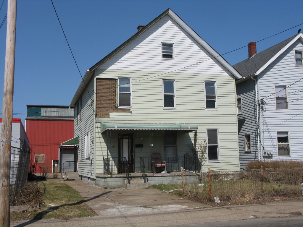
Address: 546 W 16 ST
Parcel: 16030027011800
Parcel Profile
Address
546 | W | 16 | ST
Street Status
PAVED
School District
CITY OF ERIE SCHOOL
Acreage
0.0588
Classification
R
Land Use Code
TWO FAMILY
Legal Description
546 W 16 ST 40 X 64
Square Feet
1872
Topo
LEVEL
Utility
ALL PUBLIC
Zoning
Please contact your municipal zoning officer
Deed Book
2014
Deed Page
005041
2026 Tax Values
Land Value / Taxable
7,700 / 7,700.00
Building Value / Taxable
24,340 / 24,340.00
Total Value / Taxable
32,040 / 32,040.00
Clean & Green
Inactive
Homestead Status
Inactive
Farmstead Status
Inactive
Lerta Amount
0
Lerta Expiration Year
0
Residential Data
Card 1
Style
CONVENTIONAL
Basement
FULL
Year Built
1906
Exterior Wall
ALUMINUM/VINYL
Total Living Area
1872
Full Baths
2
Half Baths
0
Fuel Type
GAS
Heating
CENTRAL
Heating System
FORCED AIR
Stories
2.0
Total Bedrooms
6
Total Family Rooms
0
Total Rooms
10
Fireplaces
0
Other Buildings & Yards
No OBY Data Found
Sales History
Sale Date
Type
Price
Book / Page
Other Info
3/21/2014
LAND & BUILDING
0
2014 / 005041
TAX DEED
10/9/2006
LAND & BUILDING
18000
1367 / 0868
DEED
12/28/1981
0
1443 / 0278
Parcel Sketches
Residential Card 1
A
MAIN
936 square feet
B
MA STOOP/TERR MAS STOOP
75 square feet
Parcel Images
Please note:
this tab is for informational purposes only and may not show all delinquencies, see the Taxes tab for more accurate delinquent taxes due.