Elected Officials
Courts
Departments
Initiatives
Open Government
About
Login / Register
Home
/
Property & Tax Records
/
Property Records
/
Property & Tax Search
/
Parcel Profile
/
Print View
Search for Another Parcel
Parcel Profile
Historical Card
Sketches
Photos
Tax Map
Taxes
Print View
Print This Page
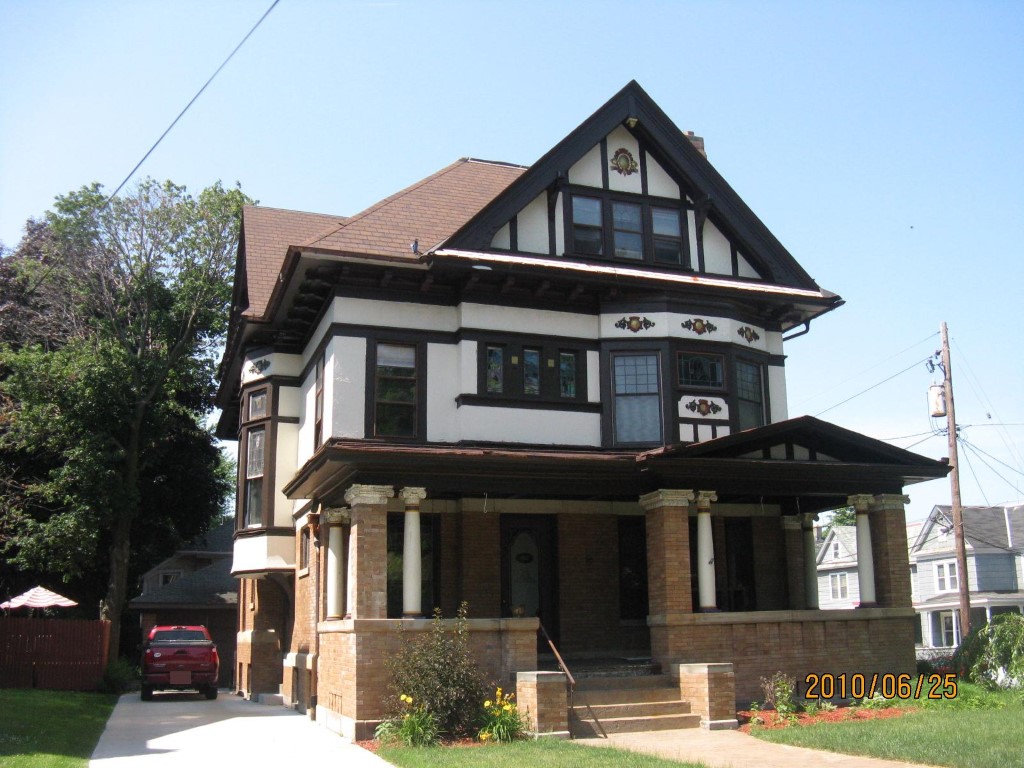
Address: 502 W 10TH ST
Parcel: 16030030010000
Parcel Profile
Address
502 | W | 10TH | ST
Street Status
PAVED | SIDEWALK
School District
CITY OF ERIE SCHOOL
Acreage
0.1791
Classification
A
Land Use Code
APARTMENTS 4 - 19 UNITS
Legal Description
502 W 10TH ST 60 X 130
Square Feet
5544
Topo
LEVEL
Utility
ALL PUBLIC
Zoning
Please contact your municipal zoning officer
Deed Book
0417
Deed Page
0572
2026 Tax Values
Land Value / Taxable
19,500 / 19,500.00
Building Value / Taxable
139,100 / 139,100.00
Total Value / Taxable
158,600 / 158,600.00
Clean & Green
Inactive
Homestead Status
Inactive
Farmstead Status
Inactive
Lerta Amount
0
Lerta Expiration Year
0
Commercial Data
Card 1
RESIDENTIAL 4 FAMILY
Business Living Area - 5544
Year Built - 1909
Improvement Name - APARTMENTS
Value - 155190
Other Buildings & Yards
Description
Built
Width
Length
Area
FRAME OR CB DETACHED GARAGE
1930
21
37
777
Sales History
Sale Date
Type
Price
Book / Page
Other Info
12/15/1995
LAND & BUILDING
125000
/
12/15/1995
0
0417 / 0572
Parcel Sketches
Commercial Card 1
A
MAIN
1774 square feet
B
MAIN
1874 square feet
C
MAIN
1896 square feet
D
MAIN
1774 square feet
Parcel Images
Please note:
this tab is for informational purposes only and may not show all delinquencies, see the Taxes tab for more accurate delinquent taxes due.