Elected Officials
Courts
Departments
Initiatives
Open Government
About
Login / Register
Home
/
Property & Tax Records
/
Property Records
/
Property & Tax Search
/
Parcel Profile
/
Print View
Search for Another Parcel
Parcel Profile
Historical Card
Sketches
Photos
Tax Map
Taxes
Print View
Print This Page
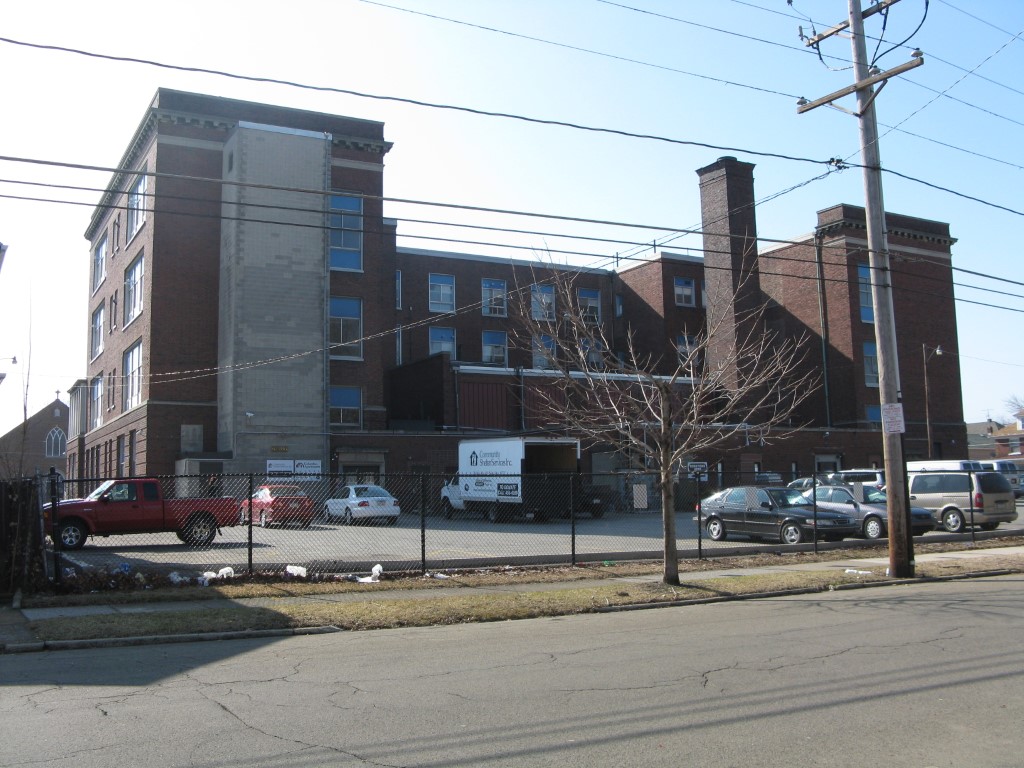
Address: 652 W 17 ST
Parcel: 16030031021500
Parcel Profile
Address
652 | W | 17 | ST
Street Status
PAVED | SIDEWALK
School District
CITY OF ERIE SCHOOL
Acreage
1.5384
Classification
E
Land Use Code
EXEMPT NON-PROFIT ORGANIZATIONS
Legal Description
652 W 17 ST 1.5384 AC
Square Feet
71770
Topo
LEVEL
Utility
ALL PUBLIC
Zoning
Please contact your municipal zoning officer
Deed Book
0839
Deed Page
1834
2026 Tax Values
Land Value / Taxable
100,500 / 100,500.00
Building Value / Taxable
1,252,500 / 1,252,500.00
Total Value / Taxable
1,353,000 / 1,353,000.00
Clean & Green
Inactive
Homestead Status
Inactive
Farmstead Status
Inactive
Lerta Amount
0
Lerta Expiration Year
0
Commercial Data
Card 1
OFFICE BLDG L/R 1-4S
Business Living Area - 71770
Year Built - 1914
Improvement Name - KEYSTONEUNIVERSAL RESEARCH
Value - 1208780
Other Buildings & Yards
No OBY Data Found
Sales History
Sale Date
Type
Price
Book / Page
Other Info
12/31/2001
LAND & BUILDING
475000
0839 / 1834
Parcel Sketches
Commercial Card 1
A
MAIN
2064 square feet
B
MAIN
22668 square feet
C
MAIN
18118 square feet
D
MAIN
12660 square feet
E
MAIN
3600 square feet
Parcel Images
Please note:
this tab is for informational purposes only and may not show all delinquencies, see the Taxes tab for more accurate delinquent taxes due.