Elected Officials
Courts
Departments
Initiatives
Open Government
About
Login / Register
Home
/
Property & Tax Records
/
Property Records
/
Property & Tax Search
/
Parcel Profile
/
Print View
Search for Another Parcel
Parcel Profile
Historical Card
Sketches
Photos
Tax Map
Taxes
Print View
Print This Page
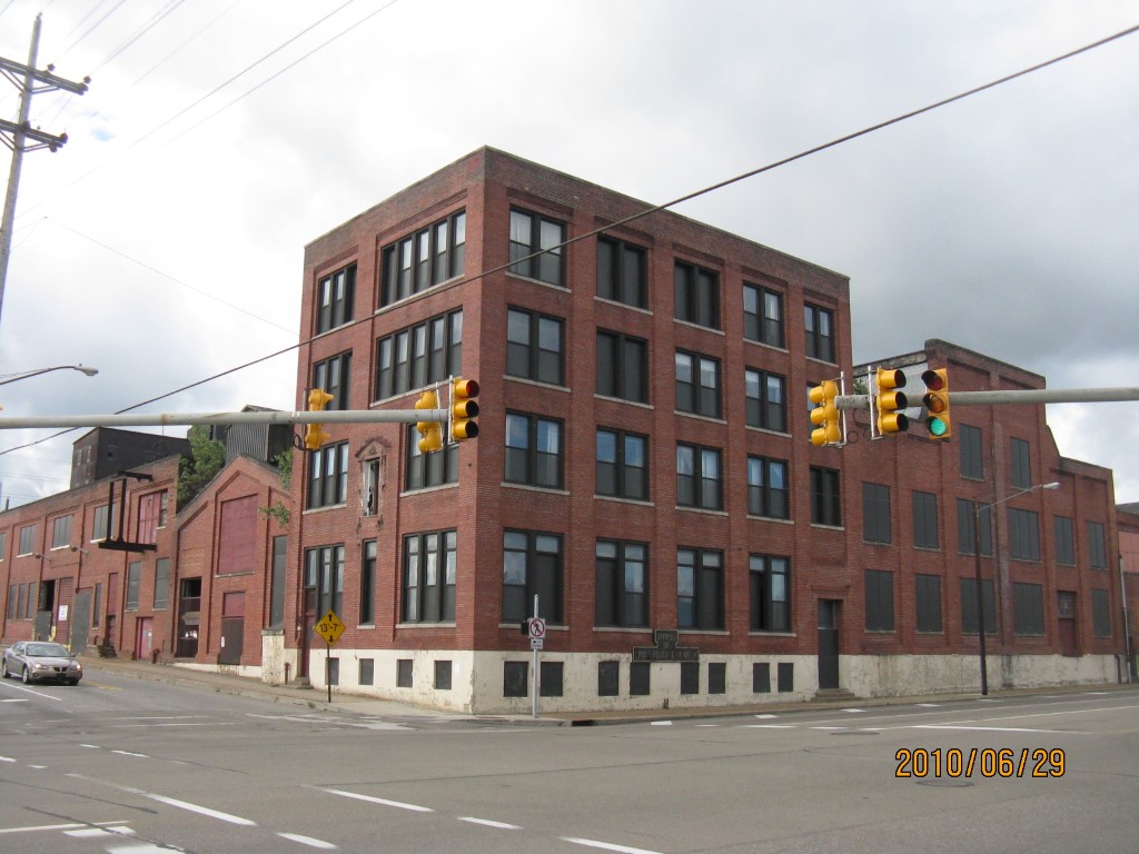
Address: 603 W 12 ST
Parcel: 16030033020000
Parcel Profile
Address
603 | W | 12 | ST
Street Status
PAVED | SIDEWALK
School District
CITY OF ERIE SCHOOL
Acreage
2.3500
Classification
C
Land Use Code
COMMERCIAL VACANT
Legal Description
603 W 12 ST 2.35 AC NET
Square Feet
76114
Topo
LEVEL
Utility
ALL PUBLIC
Zoning
Please contact your municipal zoning officer
Deed Book
2023
Deed Page
016326
2026 Tax Values
Land Value / Taxable
97,000 / 97,000.00
Building Value / Taxable
0 / 0.00
Total Value / Taxable
97,000 / 97,000.00
Clean & Green
Inactive
Homestead Status
Inactive
Farmstead Status
Inactive
Lerta Amount
0
Lerta Expiration Year
0
Commercial Data
Card 1
WAREHOUSE
Business Living Area - 76114
Year Built - 1920
Improvement Name - GUNITE ACQUISTION CORP
Value - 47670
Other Buildings & Yards
No OBY Data Found
Sales History
Sale Date
Type
Price
Book / Page
Other Info
9/27/2023
LAND
0
2023 / 016326
SPECIAL WARRANTY DEED
6/6/2023
LAND & BUILDING
0
2023 / 008753
SPECIAL WARRANTY DEED
4/15/2021
LAND & BUILDING
375000
2021 / 009142
SPECIAL WARRANTY DEED
5/17/2007
LAND & BUILDING
37500
1416 / 1497
DEED
5/18/1999
LAND & BUILDING
0
636 / 1951
Parcel Sketches
Commercial Card 1
A
MAIN
2665 square feet
B
MAIN
2665 square feet
C
MAIN
2665 square feet
D
MAIN
4492 square feet
E
MAIN
4492 square feet
F
MAIN
56470 square feet
Parcel Images
Please note:
this tab is for informational purposes only and may not show all delinquencies, see the Taxes tab for more accurate delinquent taxes due.