Elected Officials
Courts
Departments
Initiatives
Open Government
About
Login / Register
Home
/
Property & Tax Records
/
Property Records
/
Property & Tax Search
/
Parcel Profile
/
Print View
Search for Another Parcel
Parcel Profile
Historical Card
Sketches
Photos
Tax Map
Taxes
Print View
Print This Page
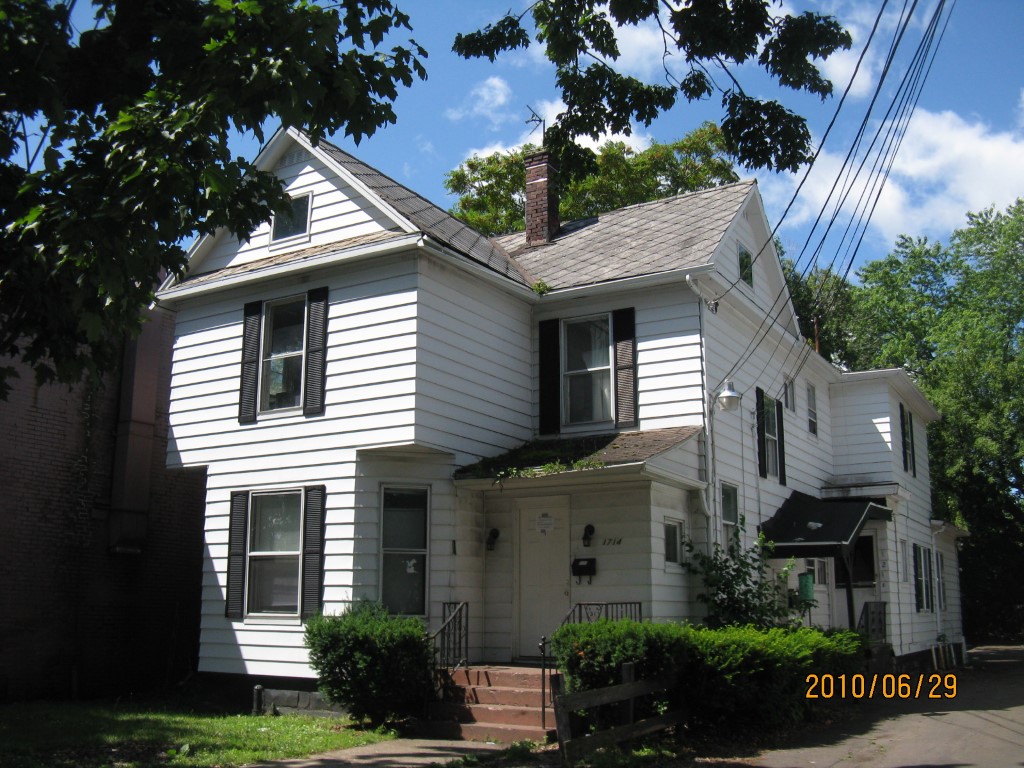
Address: 1714 LIBERTY ST
Parcel: 16030036040100
Parcel Profile
Address
1714 | LIBERTY | ST
Street Status
PAVED | SIDEWALK
School District
CITY OF ERIE SCHOOL
Acreage
0.1320
Classification
A
Land Use Code
APARTMENTS 4 - 19 UNITS
Legal Description
1714 LIBERTY ST 18.8 X 165
Square Feet
5309
Topo
LEVEL
Utility
ALL PUBLIC
Zoning
Please contact your municipal zoning officer
Deed Book
2022
Deed Page
006809
2026 Tax Values
Land Value / Taxable
14,300 / 14,300.00
Building Value / Taxable
49,700 / 49,700.00
Total Value / Taxable
64,000 / 64,000.00
Clean & Green
Inactive
Homestead Status
Inactive
Farmstead Status
Inactive
Lerta Amount
0
Lerta Expiration Year
0
Commercial Data
Card 1
RESIDENTIAL 4 FAMILY
Business Living Area - 5309
Year Built - 1905
Improvement Name - APARTMENTS
Value - 55510
Other Buildings & Yards
Description
Built
Width
Length
Area
FRAME OR CB DETACHED GARAGE
1920
0
0
580
PAVING ASPHALT PARKING
1920
0
0
2500
Sales History
Sale Date
Type
Price
Book / Page
Other Info
3/31/2022
LAND & BUILDING
0
2022 / 006809
SPECIAL WARRANTY DEED
11/12/2021
LAND & BUILDING
136000
2021 / 030394
SPECIAL WARRANTY DEED
8/18/2020
LAND & BUILDING
137150
2020 / 016097
SPECIAL WARRANTY DEED
9/29/1989
0
0100 / 1653
Parcel Sketches
Commercial Card 1
A
MAIN
1228 square feet
B
MAIN
1228 square feet
C
MAIN
1228 square feet
D
MAIN
614 square feet
E
MAIN
420 square feet
F
MAIN
420 square feet
G
MAIN
144 square feet
H
MAIN
27 square feet
Parcel Images
Please note:
this tab is for informational purposes only and may not show all delinquencies, see the Taxes tab for more accurate delinquent taxes due.