Elected Officials
Courts
Departments
Initiatives
Open Government
About
Login / Register
Home
/
Property & Tax Records
/
Property Records
/
Property & Tax Search
/
Parcel Profile
/
Print View
Search for Another Parcel
Parcel Profile
Historical Card
Sketches
Photos
Tax Map
Taxes
Print View
Print This Page
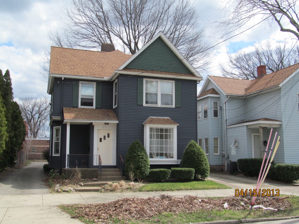
Address: 815 W 10 ST
Parcel: 16030041020700
Parcel Profile
Address
815 | W | 10 | ST
Street Status
PAVED | SIDEWALK
School District
CITY OF ERIE SCHOOL
Acreage
0.1562
Classification
R
Land Use Code
DWELLING W/ COMMERCIAL USE PRIMARY RES
Legal Description
815 W 10 ST 41.25X165
Square Feet
2048
Topo
LEVEL
Utility
ALL PUBLIC
Zoning
Please contact your municipal zoning officer
Deed Book
2018
Deed Page
017465
2026 Tax Values
Land Value / Taxable
9,600 / 9,600.00
Building Value / Taxable
78,390 / 78,390.00
Total Value / Taxable
87,990 / 87,990.00
Clean & Green
Inactive
Homestead Status
Inactive
Farmstead Status
Inactive
Lerta Amount
0.00
Lerta Expiration Year
2017
Residential Data
Card 1
Style
OLD STYLE
Basement
FULL
Year Built
1902
Exterior Wall
ALUMINUM/VINYL
Total Living Area
2048
Full Baths
2
Half Baths
0
Fuel Type
GAS
Heating
CENTRAL A/C
Heating System
FORCED AIR
Stories
2.0
Total Bedrooms
5
Total Family Rooms
0
Total Rooms
12
Fireplaces
0
Other Buildings & Yards
Description
Built
Width
Length
Area
CARPORT
2012
26
19
494
Sales History
Sale Date
Type
Price
Book / Page
Other Info
8/24/2018
LAND & BUILDING
110000
2018 / 017465
DEED
3/30/2012
LAND & BUILDING
85000
2012 / 007984
DEED
Parcel Sketches
Residential Card 1
A
MAIN
1019 square feet
B
EFP ENCL FRAME PORCH
78 square feet
C
EFP ENCL FRAME PORCH
25 square feet
D
OFP OPEN FRAME PORCH
47 square feet
E
FROVR FRAME OVERHANG AT UN ATTIC-UNFINISHED
5 square feet
F
FROVR FRAME OVERHANG AT UN ATTIC-UNFINISHED
5 square feet
G
MA_PT CONC/MAS PATIO
176 square feet
H
WDDCK WOOD DECKS
176 square feet
Parcel Images
Please note:
this tab is for informational purposes only and may not show all delinquencies, see the Taxes tab for more accurate delinquent taxes due.