Elected Officials
Courts
Departments
Initiatives
Open Government
About
Login / Register
Home
/
Property & Tax Records
/
Property Records
/
Property & Tax Search
/
Parcel Profile
/
Print View
Search for Another Parcel
Parcel Profile
Historical Card
Sketches
Photos
Tax Map
Taxes
Print View
Print This Page
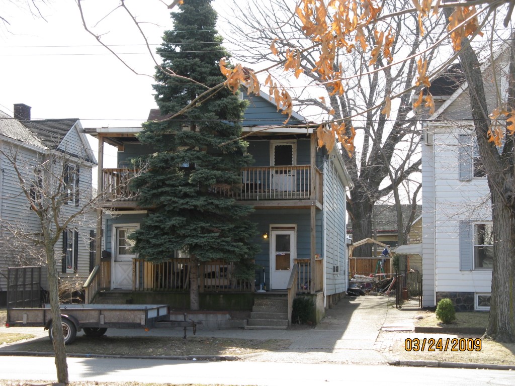
Address: 825 27 W 10 ST
Parcel: 16030041021000
Parcel Profile
Address
825 | 27 | W | 10 | ST
Street Status
PAVED
School District
CITY OF ERIE SCHOOL
Acreage
0.1172
Classification
R
Land Use Code
TWO FAMILY
Legal Description
825 27 W 10TH 41*25X123*75
Topo
LEVEL
Utility
ALL PUBLIC
Zoning
Please contact your municipal zoning officer
Deed Book
2023
Deed Page
000272
2026 Tax Values
Land Value / Taxable
9,300 / 9,300.00
Building Value / Taxable
22,250 / 22,250.00
Total Value / Taxable
31,550 / 31,550.00
Clean & Green
Inactive
Homestead Status
Inactive
Farmstead Status
Inactive
Lerta Amount
0
Lerta Expiration Year
0
Residential Data
Card 1
Style
OLD STYLE
Basement
FULL
Year Built
1892
Exterior Wall
ALUMINUM/VINYL
Total Living Area
2677
Full Baths
2
Half Baths
0
Fuel Type
GAS
Heating
CENTRAL
Heating System
FORCED AIR
Stories
2.0
Total Bedrooms
5
Total Family Rooms
0
Total Rooms
12
Fireplaces
0
Other Buildings & Yards
No OBY Data Found
Sales History
Sale Date
Type
Price
Book / Page
Other Info
1/6/2023
LAND & BUILDING
0
2023 / 000272
TAX DEED
12/31/1970
0
1036 / 0182
Parcel Sketches
Residential Card 1
A
MAIN
1196 square feet
B
FRBAY FRAME BAY
21 square feet
C
1S FR ONE STORY FRAME
264 square feet
D
OFP OPEN FRAME PORCH OFP OPEN FRAME PORCH
176 square feet
E
EFP ENCL FRAME PORCH
16 square feet
Parcel Images
Please note:
this tab is for informational purposes only and may not show all delinquencies, see the Taxes tab for more accurate delinquent taxes due.