Elected Officials
Courts
Departments
Initiatives
Open Government
About
Login / Register
Home
/
Property & Tax Records
/
Property Records
/
Property & Tax Search
/
Parcel Profile
/
Print View
Search for Another Parcel
Parcel Profile
Historical Card
Sketches
Photos
Tax Map
Taxes
Print View
Print This Page
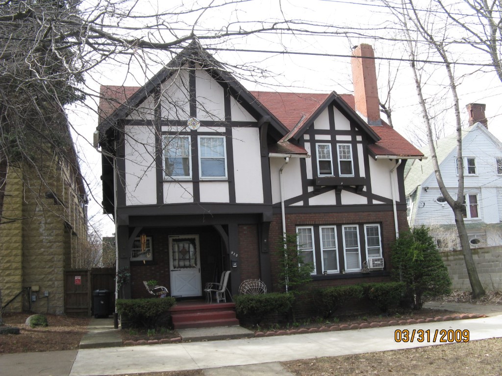
Address: 912 LIBERTY ST
Parcel: 16030042010300
Parcel Profile
Address
912 | LIBERTY | ST
Street Status
PAVED
School District
CITY OF ERIE SCHOOL
Acreage
0.0923
Classification
R
Land Use Code
SINGLE FAMILY
Legal Description
912 LIBERTY ST 48.75 X 82.5
Square Feet
1734
Topo
LEVEL
Utility
ALL PUBLIC
Zoning
Please contact your municipal zoning officer
Deed Book
2017
Deed Page
026288
2026 Tax Values
Land Value / Taxable
8,600 / 8,600.00
Building Value / Taxable
56,630 / 56,630.00
Total Value / Taxable
65,230 / 65,230.00
Clean & Green
Inactive
Homestead Status
Active
Farmstead Status
Inactive
Lerta Amount
0
Lerta Expiration Year
0
Residential Data
Card 1
Style
TUDOR
Basement
FULL
Year Built
1908
Exterior Wall
MASONRY & FRAME
Total Living Area
1734
Full Baths
1
Half Baths
0
Fuel Type
GAS
Heating
CENTRAL
Heating System
FORCED AIR
Stories
2.0
Total Bedrooms
4
Total Family Rooms
0
Total Rooms
8
Fireplaces
0
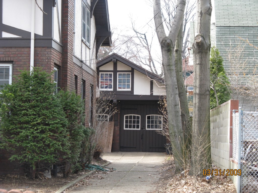
Other Buildings & Yards
Description
Built
Width
Length
Area
FRAME OR CB DETACHED GARAGE
1920
20
30
600
Sales History
Sale Date
Type
Price
Book / Page
Other Info
11/30/2017
LAND & BUILDING
0
2017 / 026288
QUIT CLAIM DEED
1/6/2011
LAND & BUILDING
0
2011 / 000587
DEED
10/27/1975
0
1180 / 0171
Parcel Sketches
Residential Card 1
A
MAIN
772 square feet
B
1S FR ONE STORY FRAME 1S FR ONE STORY FRAME
40 square feet
C
OFP OPEN FRAME PORCH 1S FR ONE STORY FRAME
88 square feet
D
FROVR FRAME OVERHANG
22 square feet
Parcel Images
Please note:
this tab is for informational purposes only and may not show all delinquencies, see the Taxes tab for more accurate delinquent taxes due.