Elected Officials
Courts
Departments
Initiatives
Open Government
About
Login / Register
Home
/
Property & Tax Records
/
Property Records
/
Property & Tax Search
/
Parcel Profile
/
Print View
Search for Another Parcel
Parcel Profile
Historical Card
Sketches
Photos
Tax Map
Taxes
Print View
Print This Page
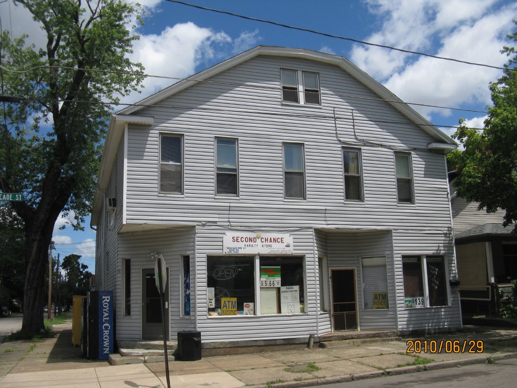
Address: 959 W 11 ST
Parcel: 16030046012100
Parcel Profile
Address
959 | W | 11 | ST
Street Status
PAVED
School District
CITY OF ERIE SCHOOL
Acreage
0.0781
Classification
C
Land Use Code
RESTAURANTS, STORES (RETAIL)
Legal Description
959 W 11 ET 1101 03 CASCADE
Square Feet
8736
Topo
LEVEL
Utility
ALL PUBLIC
Zoning
Please contact your municipal zoning officer
Deed Book
2019
Deed Page
012403
2026 Tax Values
Land Value / Taxable
6,800 / 6,800.00
Building Value / Taxable
65,200 / 65,200.00
Total Value / Taxable
72,000 / 72,000.00
Clean & Green
Inactive
Homestead Status
Inactive
Farmstead Status
Inactive
Lerta Amount
0
Lerta Expiration Year
0
Commercial Data
Card 1
MIXED RESIDENTIAL/COMMERCIAL
Business Living Area - 8736
Year Built - 1900
Improvement Name - 2ND CHANCE VARIETY AND APTS
Value - 71150
Other Buildings & Yards
No OBY Data Found
Sales History
Sale Date
Type
Price
Book / Page
Other Info
6/28/2019
LAND & BUILDING
94000
2019 / 012403
SPECIAL WARRANTY DEED
6/1/2016
LAND & BUILDING
66000
2016 / 011024
SPECIAL WARRANTY DEED
5/4/2005
LAND & BUILDING
68000
1231 / 0870
SPECIAL WARRANTY DEED
5/1/1998
0
0558 / 0531
Parcel Sketches
Commercial Card 1
A
MAIN
2508 square feet
B
MAIN
1748 square feet
C
MAIN
718 square feet
D
MAIN
2508 square feet
E
MAIN
1254 square feet
Parcel Images
Please note:
this tab is for informational purposes only and may not show all delinquencies, see the Taxes tab for more accurate delinquent taxes due.