Elected Officials
Courts
Departments
Initiatives
Open Government
About
Login / Register
Home
/
Property & Tax Records
/
Property Records
/
Property & Tax Search
/
Parcel Profile
/
Print View
Search for Another Parcel
Parcel Profile
Historical Card
Sketches
Photos
Tax Map
Taxes
Print View
Print This Page
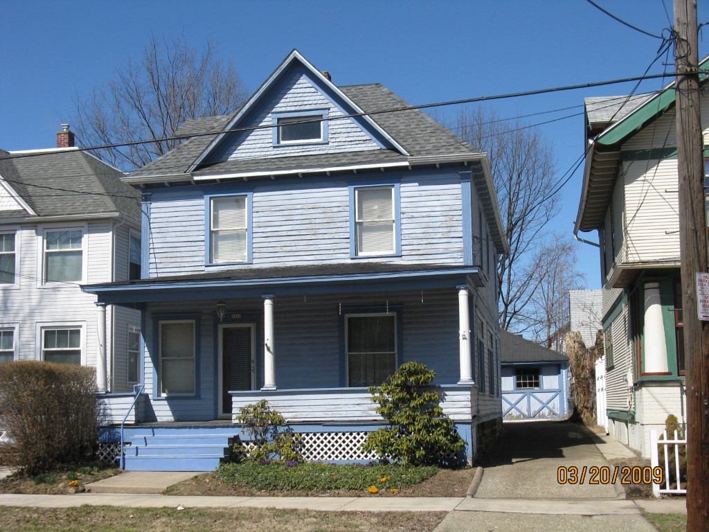
Address: 1216 W 9 ST
Parcel: 16030059024100
Parcel Profile
Address
1216 | W | 9 | ST
Street Status
PAVED
School District
CITY OF ERIE SCHOOL
Acreage
0.1326
Classification
R
Land Use Code
SINGLE FAMILY
Legal Description
1216 W 9 ST 35X165
Square Feet
1938
Topo
LEVEL
Utility
ALL PUBLIC
Zoning
Please contact your municipal zoning officer
Deed Book
1058
Deed Page
347
2026 Tax Values
Land Value / Taxable
9,400 / 9,400.00
Building Value / Taxable
50,600 / 50,600.00
Total Value / Taxable
60,000 / 60,000.00
Clean & Green
Inactive
Homestead Status
Active
Farmstead Status
Inactive
Lerta Amount
0
Lerta Expiration Year
0
Residential Data
Card 1
Style
OLD STYLE
Basement
FULL
Year Built
1902
Exterior Wall
FRAME
Total Living Area
1938
Full Baths
1
Half Baths
0
Fuel Type
GAS
Heating
CENTRAL
Heating System
FORCED AIR
Stories
2.0
Total Bedrooms
4
Total Family Rooms
0
Total Rooms
8
Fireplaces
0
Other Buildings & Yards
Description
Built
Width
Length
Area
FRAME OR CB DETACHED GARAGE
1916
18
20
360
Sales History
Sale Date
Type
Price
Book / Page
Other Info
8/29/2003
LAND & BUILDING
35000
1058 / 347
WARRANTY/SURVIVORSHIP DEED
11/9/1983
0
1515 / 0406
Parcel Sketches
Residential Card 1
A
MAIN
960 square feet
B
OFP OPEN FRAME PORCH
168 square feet
C
FRBAY FRAME BAY
18 square feet
D
OFP OPEN FRAME PORCH
105 square feet
Parcel Images
Please note:
this tab is for informational purposes only and may not show all delinquencies, see the Taxes tab for more accurate delinquent taxes due.