Elected Officials
Courts
Departments
Initiatives
Open Government
About
Login / Register
Home
/
Property & Tax Records
/
Property Records
/
Property & Tax Search
/
Parcel Profile
/
Print View
Search for Another Parcel
Parcel Profile
Historical Card
Sketches
Photos
Tax Map
Taxes
Print View
Print This Page
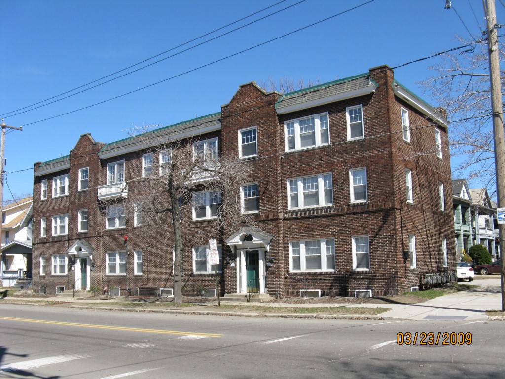
Address: 923 29 WESCHLER AVE
Parcel: 16030061012800
Parcel Profile
Address
923 | 29 | WESCHLER | AVE
Street Status
PAVED
School District
CITY OF ERIE SCHOOL
Acreage
0.0977
Classification
A
Land Use Code
APARTMENTS 4 - 19 UNITS
Legal Description
923-929 WESCHLER AVE
Square Feet
8064
Topo
LEVEL
Utility
ALL PUBLIC
Zoning
Please contact your municipal zoning officer
Deed Book
2022
Deed Page
019673
2026 Tax Values
Land Value / Taxable
15,900 / 15,900.00
Building Value / Taxable
352,300 / 352,300.00
Total Value / Taxable
368,200 / 368,200.00
Clean & Green
Inactive
Homestead Status
Inactive
Farmstead Status
Inactive
Lerta Amount
0.00
Lerta Expiration Year
2016
Commercial Data
Card 1
APARTMENTS - GARDEN
Business Living Area - 8064
Year Built - 1917
Improvement Name - #29 923-929 WESCHLER
Value - 447970
Other Buildings & Yards
No OBY Data Found
Sales History
Sale Date
Type
Price
Book / Page
Other Info
9/8/2022
LAND & BUILDING
14500000
2022 / 019673
SPECIAL WARRANTY DEED
7/2/2019
LAND & BUILDING
9995000
2019 / 012683
SPECIAL WARRANTY DEED
3/12/2013
LAND & BUILDING
0
2013 / 005697
DEED
10/6/2004
LAND & BUILDING
1800000
1179 / 0982
DEED
9/30/2003
LAND & BUILDING
0
1070 / 759
SHERIFF'S DED
10/15/1999
LAND & BUILDING
3450000
668 / 259
Parcel Sketches
Commercial Card 1
A
MAIN
2688 square feet
B
MAIN
2688 square feet
C
MAIN
2688 square feet
D
MAIN
2688 square feet
Parcel Images
Please note:
this tab is for informational purposes only and may not show all delinquencies, see the Taxes tab for more accurate delinquent taxes due.