Elected Officials
Courts
Departments
Initiatives
Open Government
About
Login / Register
Home
/
Property & Tax Records
/
Property Records
/
Property & Tax Search
/
Parcel Profile
/
Print View
Search for Another Parcel
Parcel Profile
Historical Card
Sketches
Photos
Tax Map
Taxes
Print View
Print This Page
Address: W 8 ST
Parcel: 16031003011700
Parcel Profile
Address
0 | W | 8 | ST
Street Status
PAVED
School District
CITY OF ERIE SCHOOL
Acreage
6.4508
Classification
I
Land Use Code
HEAVY INDUSTRIAL
Legal Description
W 8 ST 6.4508 AC
Square Feet
116550
Topo
LEVEL
Utility
ALL PUBLIC
Zoning
Please contact your municipal zoning officer
Deed Book
1552
Deed Page
0380
2026 Tax Values
Land Value / Taxable
322,500 / 322,500.00
Building Value / Taxable
389,500 / 389,500.00
Total Value / Taxable
712,000 / 712,000.00
Clean & Green
Inactive
Homestead Status
Inactive
Farmstead Status
Inactive
Lerta Amount
0
Lerta Expiration Year
0
Commercial Data
Card 1
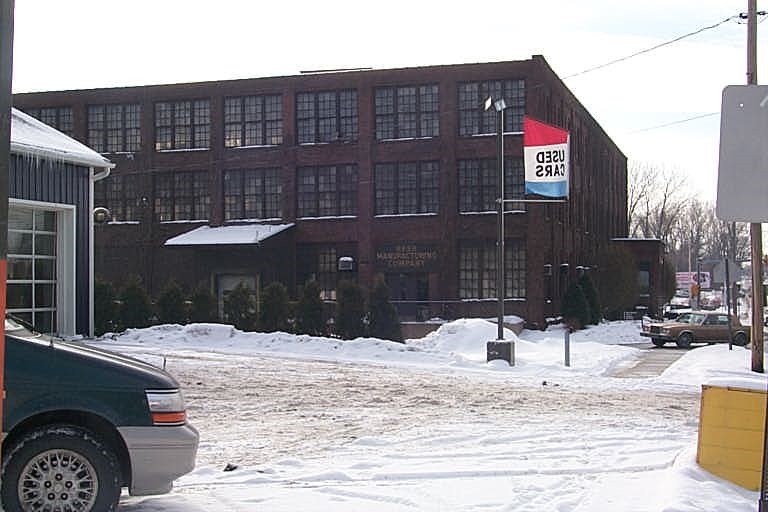
WAREHOUSE
Business Living Area - 113146
Year Built - 1899
Improvement Name - REED MFG CO
Value - 848910
Card 2
WAREHOUSE
Business Living Area - 3404
Year Built - 1960
Improvement Name - REED MFG CO
Value - 38450
Other Buildings & Yards
No OBY Data Found
Sales History
Sale Date
Type
Price
Book / Page
Other Info
9/17/1984
0
1552 / 0380
9/17/1984
0
1552 / 0392
Parcel Sketches
Commercial Card 1
A
MAIN
2400 square feet
B
MAIN
5760 square feet
C
MAIN
4800 square feet
D
MAIN
36345 square feet
E
MAIN
28350 square feet
F
MAIN
10350 square feet
G
MAIN
22741 square feet
Commercial Card 2
A
MAIN
2116 square feet
B
MAIN
1288 square feet
Parcel Images
Please note:
this tab is for informational purposes only and may not show all delinquencies, see the Taxes tab for more accurate delinquent taxes due.