Elected Officials
Courts
Departments
Initiatives
Open Government
About
Login / Register
Home
/
Property & Tax Records
/
Property Records
/
Property & Tax Search
/
Parcel Profile
/
Print View
Search for Another Parcel
Parcel Profile
Historical Card
Sketches
Photos
Tax Map
Taxes
Print View
Print This Page
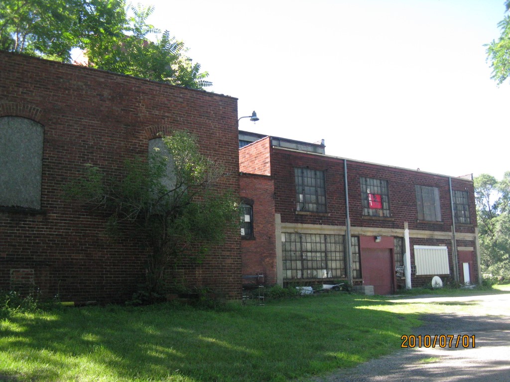
Address: 1951 GROVE DR
Parcel: 16031013011000
Parcel Profile
Address
1951 | GROVE | DR
Street Status
PAVED
School District
CITY OF ERIE SCHOOL
Acreage
2.9050
Classification
C
Land Use Code
WAREHOUSES
Legal Description
19561 GROVE DR 2.905 AC
Square Feet
48197
Topo
LEVEL
Utility
ALL PUBLIC
Zoning
Please contact your municipal zoning officer
Deed Book
0382
Deed Page
0001
2026 Tax Values
Land Value / Taxable
60,000 / 60,000.00
Building Value / Taxable
40,000 / 40,000.00
Total Value / Taxable
100,000 / 100,000.00
Clean & Green
Inactive
Homestead Status
Inactive
Farmstead Status
Inactive
Lerta Amount
0
Lerta Expiration Year
0
Commercial Data
Card 1
WAREHOUSE
Business Living Area - 48197
Year Built - 1905
Improvement Name - CONTINENTAL RUBBER COMPANY
Value - 353940
Other Buildings & Yards
No OBY Data Found
Sales History
Sale Date
Type
Price
Book / Page
Other Info
5/3/1995
0
0382 / 0001
Parcel Sketches
Commercial Card 1
A
MAIN
27695 square feet
B
MAIN
18717 square feet
C
MAIN
3000 square feet
D
MAIN
700 square feet
E
MAIN
10256 square feet
F
MAIN
10246 square feet
G
MAIN
960 square feet
Parcel Images
Please note:
this tab is for informational purposes only and may not show all delinquencies, see the Taxes tab for more accurate delinquent taxes due.