Elected Officials
Courts
Departments
Initiatives
Open Government
About
Login / Register
Home
/
Property & Tax Records
/
Property Records
/
Property & Tax Search
/
Parcel Profile
/
Print View
Search for Another Parcel
Parcel Profile
Historical Card
Sketches
Photos
Tax Map
Taxes
Print View
Print This Page
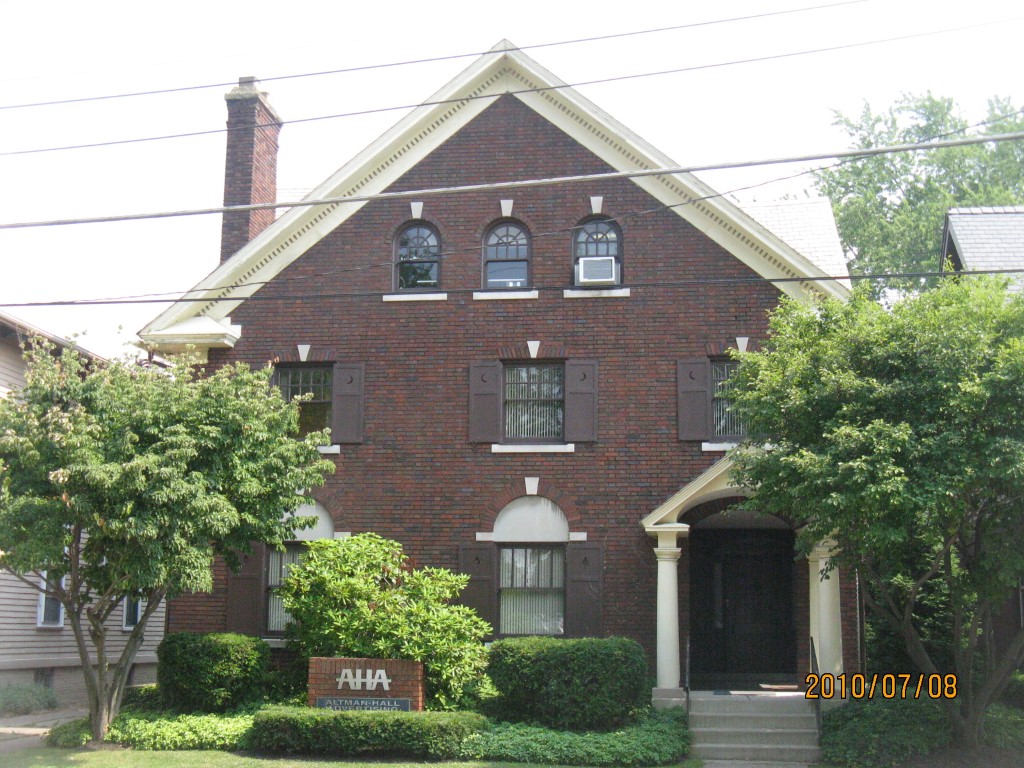
Address: 235 W 7 ST
Parcel: 17040007011300
Parcel Profile
Address
235 | W | 7 | ST
Street Status
PAVED
School District
CITY OF ERIE SCHOOL
Acreage
0.2003
Classification
C
Land Use Code
OFFICE BLDGS/LABS/LIBRARIES
Legal Description
235 W 7 ST 52.87 X 165
Square Feet
5170
Topo
LEVEL
Utility
ALL PUBLIC
Zoning
Please contact your municipal zoning officer
Deed Book
1507
Deed Page
1765
2026 Tax Values
Land Value / Taxable
34,900 / 34,900.00
Building Value / Taxable
134,300 / 134,300.00
Total Value / Taxable
169,200 / 169,200.00
Clean & Green
Inactive
Homestead Status
Inactive
Farmstead Status
Inactive
Lerta Amount
0
Lerta Expiration Year
0
Commercial Data
Card 1
MIXED RESIDENTIAL/COMMERCIAL
Business Living Area - 5170
Year Built - 1925
Improvement Name - ALTMAN ADVERTISING
Value - 177650
Other Buildings & Yards
Description
Built
Width
Length
Area
FRAME OR CB DETACHED GARAGE
1925
22
50
1100
PAVING CONCRETE AVERAGE
1970
45
69
3105
Sales History
Sale Date
Type
Price
Book / Page
Other Info
7/8/2008
LAND & BUILDING
0
1507 / 1765
DEED
12/23/1985
0
1613 / 0001
Parcel Sketches
Commercial Card 1
A
MAIN
1775 square feet
B
MAIN
1775 square feet
C
MAIN
1620 square feet
D
MAIN
810 square feet
Parcel Images
Please note:
this tab is for informational purposes only and may not show all delinquencies, see the Taxes tab for more accurate delinquent taxes due.