Elected Officials
Courts
Departments
Initiatives
Open Government
About
Login / Register
Home
/
Property & Tax Records
/
Property Records
/
Property & Tax Search
/
Parcel Profile
/
Print View
Search for Another Parcel
Parcel Profile
Historical Card
Sketches
Photos
Tax Map
Taxes
Print View
Print This Page
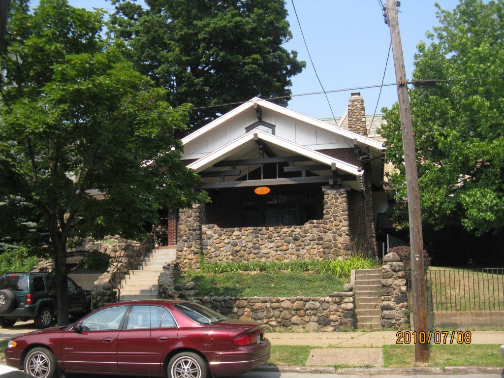
Address: 627 MYRTLE ST
Parcel: 17040007020900
Parcel Profile
Address
627 | MYRTLE | ST
Street Status
PAVED
School District
CITY OF ERIE SCHOOL
Acreage
0.1148
Classification
C
Land Use Code
OFFICE BLDGS/LABS/LIBRARIES
Legal Description
627 MYRTLE ST 50X100
Square Feet
2442
Topo
LEVEL
Utility
ALL PUBLIC
Zoning
Please contact your municipal zoning officer
Deed Book
0408
Deed Page
0405
2026 Tax Values
Land Value / Taxable
20,000 / 20,000.00
Building Value / Taxable
74,600 / 74,600.00
Total Value / Taxable
94,600 / 94,600.00
Clean & Green
Inactive
Homestead Status
Inactive
Farmstead Status
Inactive
Lerta Amount
0
Lerta Expiration Year
0
Commercial Data
Card 1
MIXED RESIDENTIAL/COMMERCIAL
Business Living Area - 2442
Year Built - 1920
Improvement Name - KIRK HOUSE
Value - 75100
Other Buildings & Yards
No OBY Data Found
Sales History
Sale Date
Type
Price
Book / Page
Other Info
7/3/1941
0
0408 / 0405
Parcel Sketches
Commercial Card 1
A
MAIN
1642 square feet
B
MAIN
1642 square feet
C
MAIN
800 square feet
Parcel Images
Please note:
this tab is for informational purposes only and may not show all delinquencies, see the Taxes tab for more accurate delinquent taxes due.