Elected Officials
Courts
Departments
Initiatives
Open Government
About
Login / Register
Home
/
Property & Tax Records
/
Property Records
/
Property & Tax Search
/
Parcel Profile
/
Print View
Search for Another Parcel
Parcel Profile
Historical Card
Sketches
Photos
Tax Map
Taxes
Print View
Print This Page
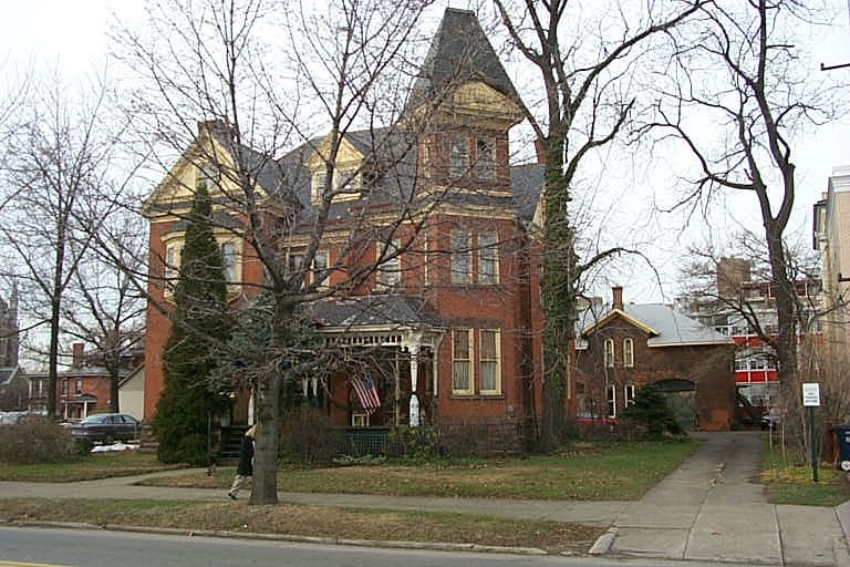
Address: 216 W 7 ST
Parcel: 17040007021900
Parcel Profile
Address
216 | W | 7 | ST
Street Status
PAVED
School District
CITY OF ERIE SCHOOL
Acreage
0.3800
Classification
C
Land Use Code
COMMERCIAL VACANT
Legal Description
216 W 7 ST 82.5 X 200.18 | 0.38 AC
Topo
LEVEL
Utility
ALL PUBLIC
Zoning
Please contact your municipal zoning officer
Deed Book
2026
Deed Page
010885
2026 Tax Values
Land Value / Taxable
20,400 / 20,400.00
Building Value / Taxable
0 / 0.00
Total Value / Taxable
20,400 / 20,400.00
Clean & Green
Inactive
Homestead Status
Inactive
Farmstead Status
Inactive
Lerta Amount
0
Lerta Expiration Year
0
Other Buildings & Yards
No OBY Data Found
Sales History
Sale Date
Type
Price
Book / Page
Other Info
6/23/2026
LAND
0
2026 / 010885
SPECIAL WARRANTY DEED
6/18/2026
LAND
0
2026 / 010601
SPECIAL WARRANTY DEED
9/1/2020
LAND & BUILDING
450000
2020 / 017495
SPECIAL WARRANTY DEED
3/27/2018
LAND & BUILDING
0
2018 / 005576
QUIT CLAIM DEED
3/1/1974
0
1114 / 0592
Parcel Sketches
Invalid Parcel Number or No Sketches on File
Parcel Images
Please note:
this tab is for informational purposes only and may not show all delinquencies, see the Taxes tab for more accurate delinquent taxes due.