Elected Officials
Courts
Departments
Initiatives
Open Government
About
Login / Register
Home
/
Property & Tax Records
/
Property Records
/
Property & Tax Search
/
Parcel Profile
/
Print View
Search for Another Parcel
Parcel Profile
Historical Card
Sketches
Photos
Tax Map
Taxes
Print View
Print This Page
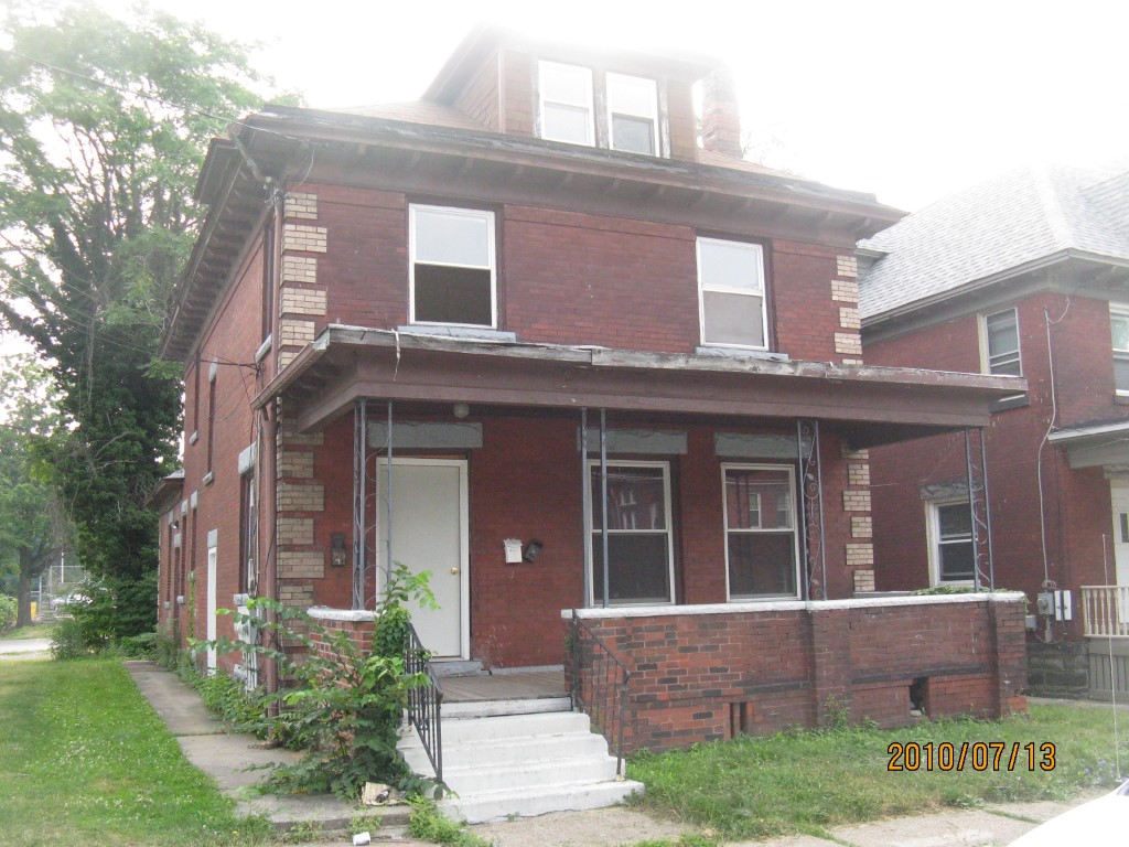
Address: 515 MYRTLE ST
Parcel: 17040008012600
Parcel Profile
Address
515 | MYRTLE | ST
Street Status
PAVED | SIDEWALK
School District
CITY OF ERIE SCHOOL
Acreage
0.0606
Classification
R
Land Use Code
TWO FAMILY
Legal Description
515 MYRTLE ST 32 X 82.5
Square Feet
3224
Topo
LEVEL
Utility
ALL PUBLIC
Zoning
Please contact your municipal zoning officer
Deed Book
2018
Deed Page
024796
2026 Tax Values
Land Value / Taxable
21,100 / 21,100.00
Building Value / Taxable
28,900 / 28,900.00
Total Value / Taxable
50,000 / 50,000.00
Clean & Green
Inactive
Homestead Status
Inactive
Farmstead Status
Inactive
Lerta Amount
0
Lerta Expiration Year
0
Commercial Data
Card 1
RESIDENTIAL 4 FAMILY
Business Living Area - 3224
Year Built - 1909
Improvement Name - APARTMENTS
Value - 70240
Other Buildings & Yards
No OBY Data Found
Sales History
Sale Date
Type
Price
Book / Page
Other Info
12/3/2018
LAND & BUILDING
5000
2018 / 024796
QUIT CLAIM DEED
5/7/2018
LAND & BUILDING
0
2018 / 008666
DECLARATION OF TAKING
4/7/2005
LAND & BUILDING
60000
1223 / 1091
DEED
10/11/2004
LAND & BUILDING
0
1180 / 2061
SHERIFF'S DED
12/4/2002
LAND & BUILDING
0
952 / 2389
AFFIDAVIT
8/12/2002
LAND & BUILDING
0
909 / 1579
AFFIDAVIT
Parcel Sketches
Commercial Card 1
A
MAIN
864 square feet
B
MAIN
1336 square feet
C
MAIN
1024 square feet
D
MAIN
432 square feet
Parcel Images
Please note:
this tab is for informational purposes only and may not show all delinquencies, see the Taxes tab for more accurate delinquent taxes due.