Elected Officials
Courts
Departments
Initiatives
Open Government
About
Login / Register
Home
/
Property & Tax Records
/
Property Records
/
Property & Tax Search
/
Parcel Profile
/
Print View
Search for Another Parcel
Parcel Profile
Historical Card
Sketches
Photos
Tax Map
Taxes
Print View
Print This Page
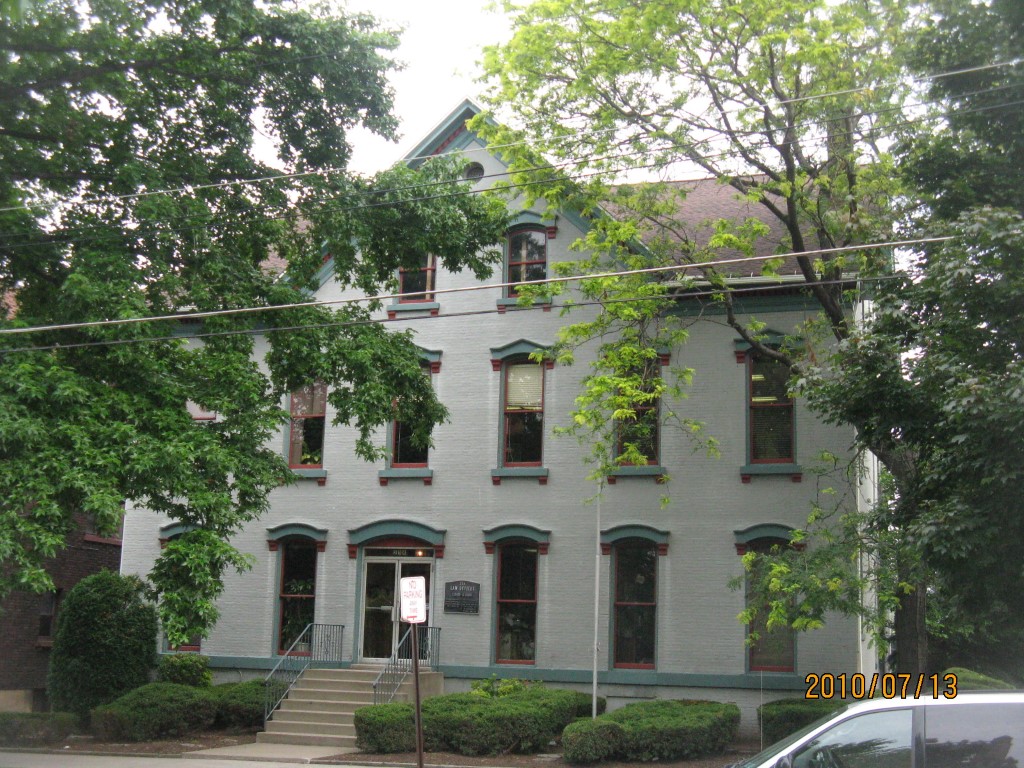
Address: 254 W 6 ST
Parcel: 17040008013000
Parcel Profile
Address
254 | W | 6 | ST
Street Status
PAVED | SIDEWALK
School District
CITY OF ERIE SCHOOL
Acreage
0.3132
Classification
C
Land Use Code
OFFICE BLDGS/LABS/LIBRARIES
Legal Description
254 WEST 6 ST IRR
Square Feet
8284
Topo
LEVEL
Utility
ALL PUBLIC
Zoning
Please contact your municipal zoning officer
Deed Book
0995
Deed Page
0485
2026 Tax Values
Land Value / Taxable
54,600 / 54,600.00
Building Value / Taxable
238,700 / 238,700.00
Total Value / Taxable
293,300 / 293,300.00
Clean & Green
Inactive
Homestead Status
Inactive
Farmstead Status
Inactive
Lerta Amount
0
Lerta Expiration Year
0
Commercial Data
Card 1
MIXED RESIDENTIAL/COMMERCIAL
Business Living Area - 8284
Year Built - 1910
Improvement Name - LAW OFFICES CARNEY AND GOOD
Value - 231740
Other Buildings & Yards
Description
Built
Width
Length
Area
PAVING ASPHALT PARKING
1980
0
0
2400
Sales History
Sale Date
Type
Price
Book / Page
Other Info
1/16/1969
0
0995 / 0485
Parcel Sketches
Commercial Card 1
A
MAIN
2760 square feet
B
MAIN
2760 square feet
C
MAIN
2764 square feet
D
MAIN
1382 square feet
Parcel Images
Please note:
this tab is for informational purposes only and may not show all delinquencies, see the Taxes tab for more accurate delinquent taxes due.