Elected Officials
Courts
Departments
Initiatives
Open Government
About
Login / Register
Home
/
Property & Tax Records
/
Property Records
/
Property & Tax Search
/
Parcel Profile
/
Print View
Search for Another Parcel
Parcel Profile
Historical Card
Sketches
Photos
Tax Map
Taxes
Print View
Print This Page
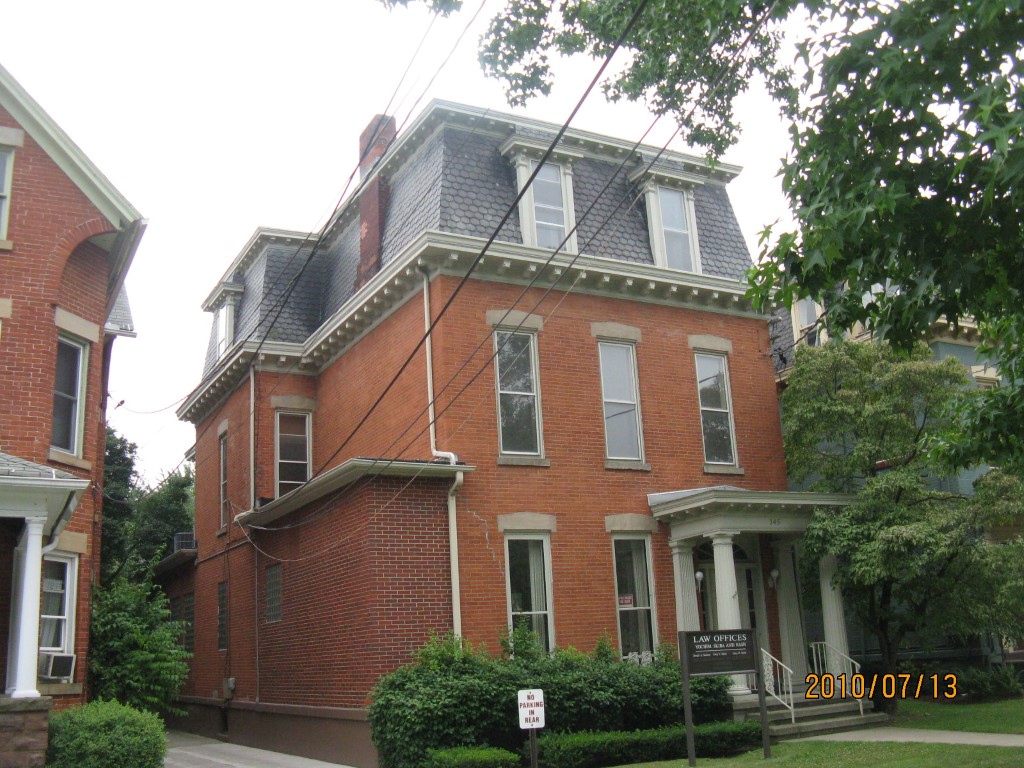
Address: 345 W 6 ST
Parcel: 17040010021000
Parcel Profile
Address
345 | W | 6 | ST
Street Status
PAVED
School District
CITY OF ERIE SCHOOL
Acreage
0.1562
Classification
C
Land Use Code
OFFICE BLDGS/LABS/LIBRARIES
Legal Description
345 W 6TH ST 41.25X165
Square Feet
7633
Topo
LEVEL
Utility
ALL PUBLIC
Zoning
Please contact your municipal zoning officer
Deed Book
2026
Deed Page
010597
2026 Tax Values
Land Value / Taxable
27,200 / 27,200.00
Building Value / Taxable
132,800 / 132,800.00
Total Value / Taxable
160,000 / 160,000.00
Clean & Green
Inactive
Homestead Status
Inactive
Farmstead Status
Inactive
Lerta Amount
0
Lerta Expiration Year
0
Commercial Data
Card 1
MIXED RESIDENTIAL/COMMERCIAL
Business Living Area - 7633
Year Built - 1872
Improvement Name - LAW OFFICES AND APARTMENT
Value - 166920
Other Buildings & Yards
No OBY Data Found
Sales History
Sale Date
Type
Price
Book / Page
Other Info
6/18/2026
LAND & BUILDING
675000
2026 / 010597
SPECIAL WARRANTY DEED
9/3/2015
LAND & BUILDING
200000
2015 / 019352
SPECIAL WARRANTY DEED
2/2/2001
LAND & BUILDING
39250
751 / 62
Parcel Sketches
Commercial Card 1
A
MAIN
1816 square feet
B
MAIN
2185 square feet
C
MAIN
1816 square feet
D
MAIN
1816 square feet
Parcel Images
Please note:
this tab is for informational purposes only and may not show all delinquencies, see the Taxes tab for more accurate delinquent taxes due.