Elected Officials
Courts
Departments
Initiatives
Open Government
About
Login / Register
Home
/
Property & Tax Records
/
Property Records
/
Property & Tax Search
/
Parcel Profile
/
Print View
Search for Another Parcel
Parcel Profile
Historical Card
Sketches
Photos
Tax Map
Taxes
Print View
Print This Page
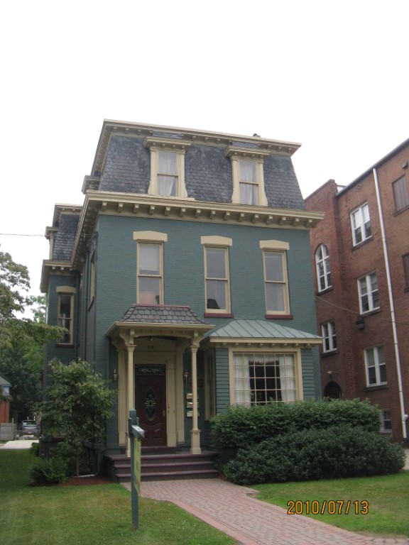
Address: 349 W 6 ST
Parcel: 17040010021100
Parcel Profile
Address
349 | W | 6 | ST
Street Status
PAVED
School District
CITY OF ERIE SCHOOL
Acreage
0.1808
Classification
C
Land Use Code
OFFICE BLDGS/LABS/LIBRARIES
Legal Description
349 W 6 ST 45 X 175
Square Feet
6503
Topo
LEVEL
Utility
ALL PUBLIC
Zoning
Please contact your municipal zoning officer
Deed Book
2026
Deed Page
001210
2026 Tax Values
Land Value / Taxable
31,500 / 31,500.00
Building Value / Taxable
149,800 / 149,800.00
Total Value / Taxable
181,300 / 181,300.00
Clean & Green
Inactive
Homestead Status
Inactive
Farmstead Status
Inactive
Lerta Amount
0.00
Lerta Expiration Year
2015
Commercial Data
Card 1
MIXED RESIDENTIAL/COMMERCIAL
Business Living Area - 6503
Year Built - 1872
Improvement Name - LAW OFFICE /APPTS
Value - 169460
Other Buildings & Yards
No OBY Data Found
Sales History
Sale Date
Type
Price
Book / Page
Other Info
1/26/2026
LAND & BUILDING
585000
2026 / 001210
SPECIAL WARRANTY DEED
1/19/2005
LAND & BUILDING
170000
1205 / 1022
WARRANTY/SURVIVORSHIP DEED
3/29/1999
LAND & BUILDING
160000
626 / 764
Parcel Sketches
Commercial Card 1
A
MAIN
1705 square feet
B
MAIN
1825 square feet
C
MAIN
1773 square feet
D
MAIN
1200 square feet
Parcel Images
Please note:
this tab is for informational purposes only and may not show all delinquencies, see the Taxes tab for more accurate delinquent taxes due.