Elected Officials
Courts
Departments
Initiatives
Open Government
About
Login / Register
Home
/
Property & Tax Records
/
Property Records
/
Property & Tax Search
/
Parcel Profile
/
Print View
Search for Another Parcel
Parcel Profile
Historical Card
Sketches
Photos
Tax Map
Taxes
Print View
Print This Page
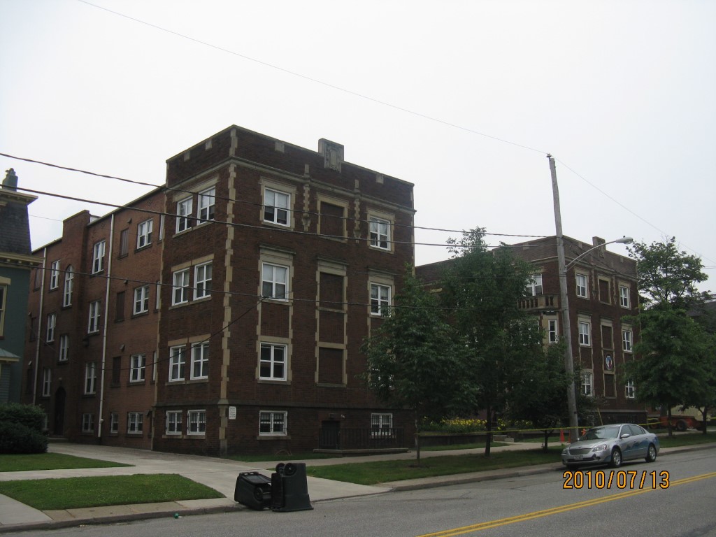
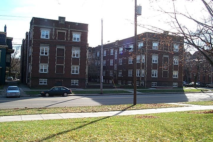
Address: 351 53 W 6 ST
Parcel: 17040010021200
Parcel Profile
Address
351 | 53 | W | 6 | ST
Street Status
PAVED
School District
CITY OF ERIE SCHOOL
Acreage
0.4731
Classification
E
Land Use Code
EXEMPT SCHOOLS
Legal Description
351 53 W 6 ST 120X165
Topo
LEVEL
Utility
ALL PUBLIC
Zoning
Please contact your municipal zoning officer
Deed Book
1404
Deed Page
0222
2026 Tax Values
Land Value / Taxable
30,900 / 30,900.00
Building Value / Taxable
1,223,800 / 1,223,800.00
Total Value / Taxable
1,254,700 / 1,254,700.00
Clean & Green
Inactive
Homestead Status
Inactive
Farmstead Status
Inactive
Lerta Amount
0
Lerta Expiration Year
0
Other Buildings & Yards
Description
Built
Width
Length
Area
DORMITORY
1928
0
0
11249
DORMITORY
1928
0
0
11103
Sales History
Sale Date
Type
Price
Book / Page
Other Info
11/14/1980
0
1404 / 0222
Parcel Sketches
Invalid Parcel Number or No Sketches on File
Parcel Images
Please note:
this tab is for informational purposes only and may not show all delinquencies, see the Taxes tab for more accurate delinquent taxes due.