Elected Officials
Courts
Departments
Initiatives
Open Government
About
Login / Register
Home
/
Property & Tax Records
/
Property Records
/
Property & Tax Search
/
Parcel Profile
/
Print View
Search for Another Parcel
Parcel Profile
Historical Card
Sketches
Photos
Tax Map
Taxes
Print View
Print This Page
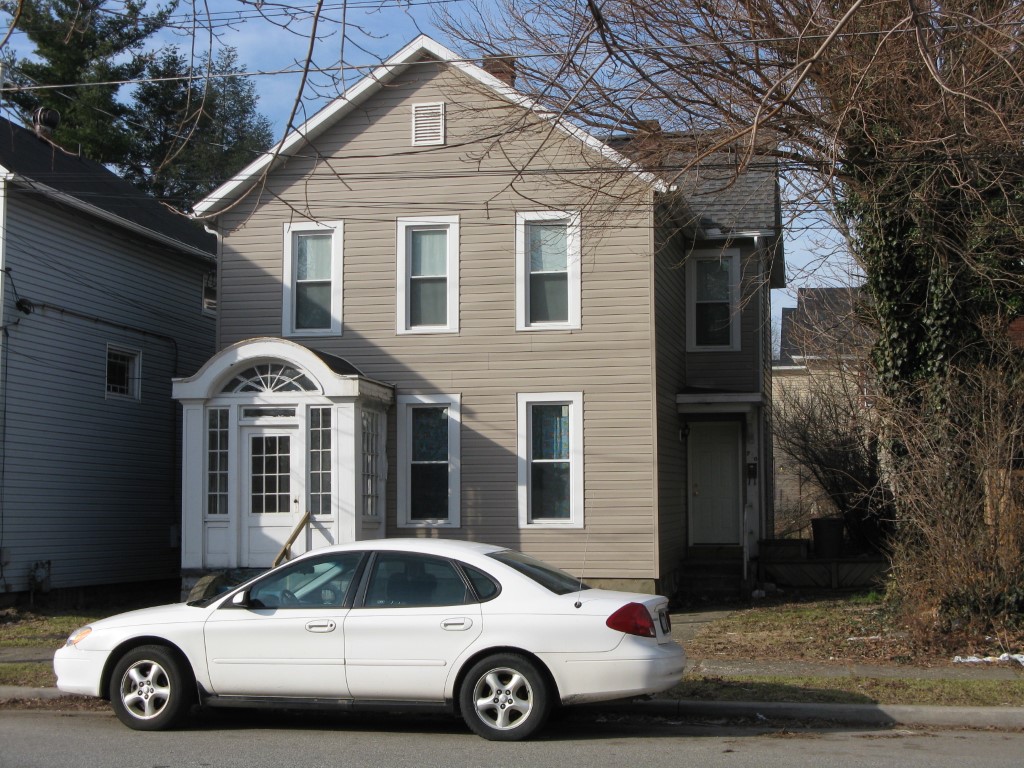
Address: 710 CHESTNUT ST
Parcel: 17040013010600
Parcel Profile
Address
710 | CHESTNUT | ST
Street Status
PAVED
School District
CITY OF ERIE SCHOOL
Acreage
0.1056
Classification
R
Land Use Code
TWO FAMILY
Legal Description
710 CHESTNUT ST 40 X 115
Square Feet
2122
Topo
LEVEL
Utility
ALL PUBLIC
Zoning
Please contact your municipal zoning officer
Deed Book
1424
Deed Page
1521
2026 Tax Values
Land Value / Taxable
8,300 / 8,300.00
Building Value / Taxable
41,700 / 41,700.00
Total Value / Taxable
50,000 / 50,000.00
Clean & Green
Inactive
Homestead Status
Inactive
Farmstead Status
Inactive
Lerta Amount
0
Lerta Expiration Year
0
Residential Data
Card 1
Style
OLD STYLE
Basement
FULL
Year Built
1892
Exterior Wall
ALUMINUM/VINYL
Total Living Area
2122
Full Baths
2
Half Baths
0
Fuel Type
GAS
Heating
NON CENTRAL
Heating System
NONE
Stories
2.0
Total Bedrooms
4
Total Family Rooms
0
Total Rooms
9
Fireplaces
0
Other Buildings & Yards
No OBY Data Found
Sales History
Sale Date
Type
Price
Book / Page
Other Info
6/19/2007
LAND & BUILDING
21000
1424 / 1521
WARRANTY/SURVIVORSHIP DEED
5/23/2007
LAND & BUILDING
0
1417 / 1930
WARRANTY/SURVIVORSHIP DEED
6/30/1992
0
0219 / 1599
Parcel Sketches
Residential Card 1
A
MAIN
676 square feet
B
WDDCK WOOD DECKS
40 square feet
C
FR UT FRAME UTILITY BUILDING
45 square feet
D
OFP OPEN FRAME PORCH
40 square feet
E
1S FR ONE STORY FRAME 1/2FR FRAME HALF-STORY
440 square feet
Parcel Images
Please note:
this tab is for informational purposes only and may not show all delinquencies, see the Taxes tab for more accurate delinquent taxes due.